19 August 2026
A major new study has uncovered extensive, unmapped rainforest communities hidden within the rugged gullies of the Greater Blue Mountains World Heritage Area (GBMWHA), challenging long-held assumptions about the region’s vegetation and raising urgent questions about fire management and conservation.
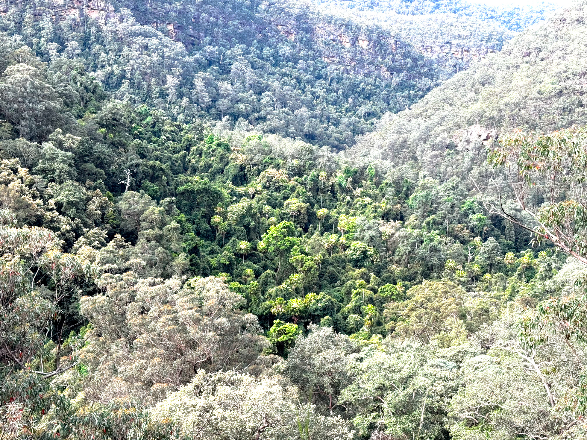
Rainforest embedded within surrounding eucalypt forest. Image: Bendall et al. (2026) / Vegetation Classification and Survey.
The research, supported by the National Environmental Science Program’s Resilient Landscapes Hub and led by Western Sydney University ecologist. Dr Eli Bendall, combined high-resolution spatial mapping with intensive field surveys across remote areas of the Hawkesbury region.
What the team discovered surprised even seasoned botanists: more than 90% of rainforest vegetation in the study area is likely to be misrepresented as sclerophyll forest in official mapping systems. In reality, these gullies are home to rich, fire-sensitive rainforest communities – some with species assemblages unlike any vegetation type currently recognised for the region.
“These are distinctive, high-diversity rainforests hiding in plain sight with characteristics more typical of coastal regions further north and south.” Dr. Bendall said. “They occur in places mapped as wet or dry sclerophyll forest, but when you get into the gullies you find complex rainforests with floristic links to coastal vegetation.”
Large increase in rainforest extent
Using field data and advanced terrain and canopy-height modelling, the research team found that rainforest extent in the study area is likely to be three to four times greater than indicated in the NSW State Vegetation Type Map.
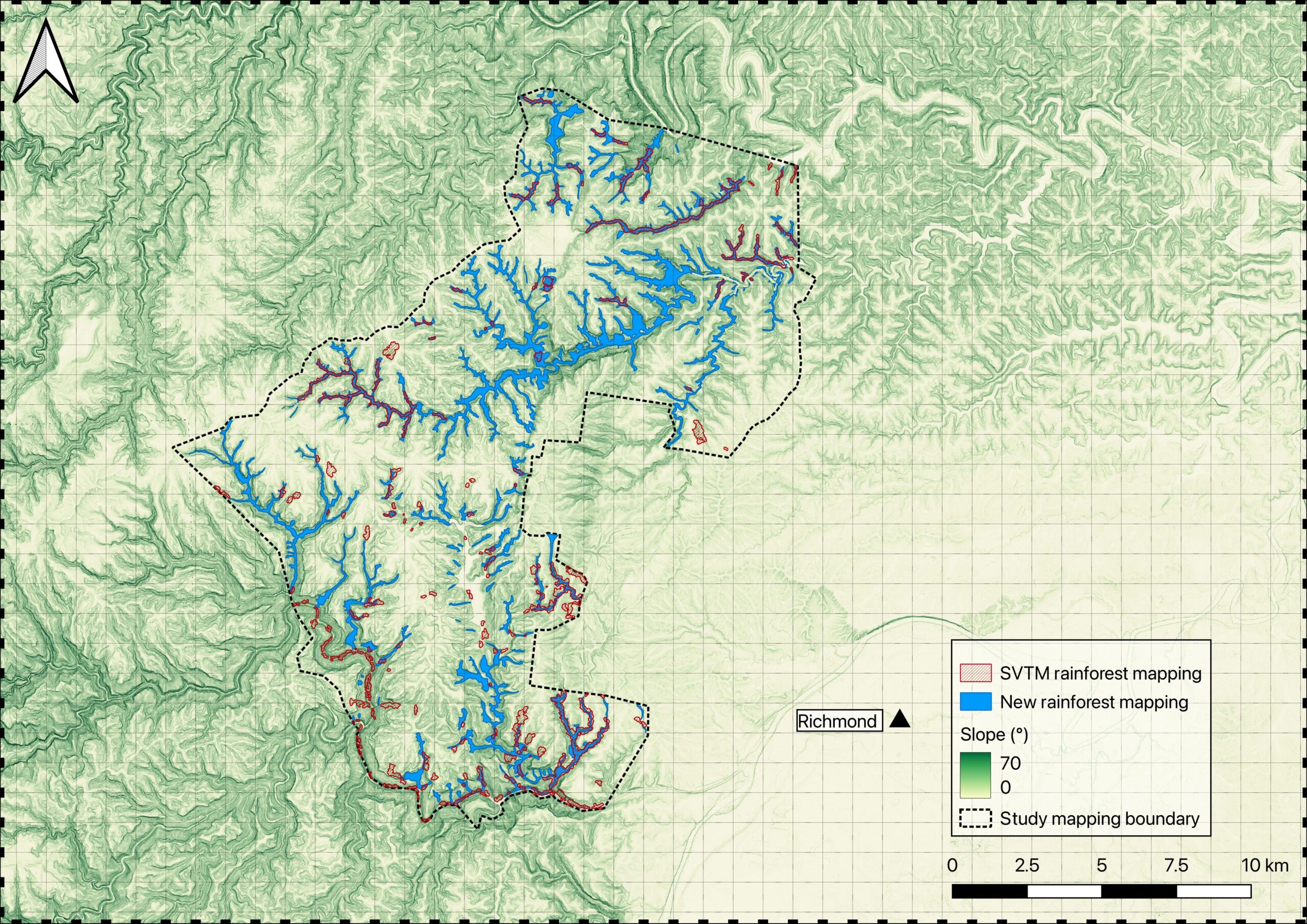
Mapping reveals areas of rainforest not captured in the NSW State Vegetation Type Map. Red hatching shows rainforest in the existing mapping, while blue shows rainforest identified through the new mapping approach. Image: Bendall et al. (2026) / Vegetation Classification and Survey.
The newly identified rainforest types – referred to as Hawkesbury Warm Sheltered Gully Rainforest and Hawkesbury Subtropical-Dry Bench Rainforest – supports:
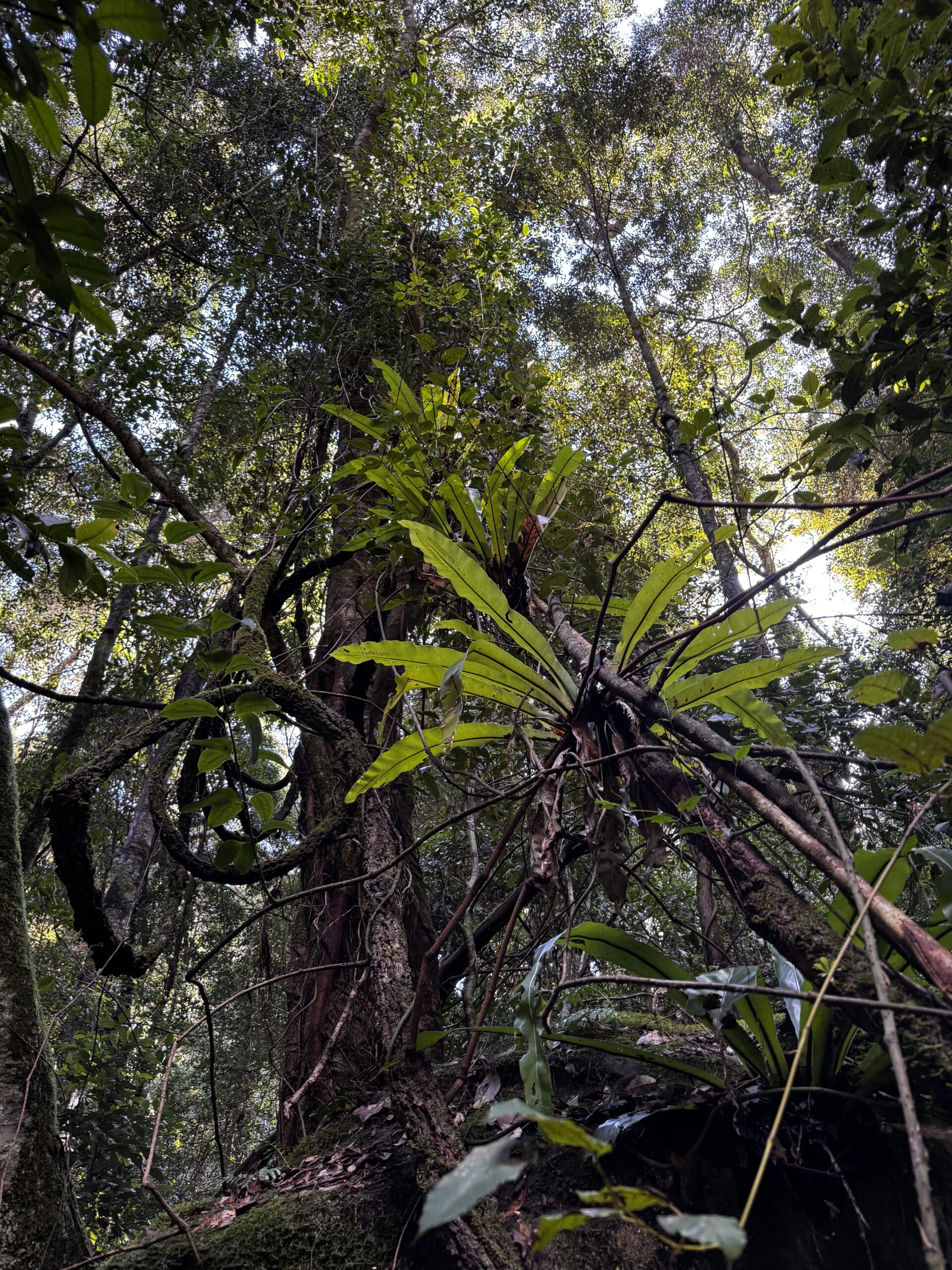
Dense rainforest vegetation, with distinctive communities rich in trees, vines, palms and ferns. Image: Eli Bendall.
Fire management risks and future threats
Because most rainforest in the study area is currently mapped as fire-prone eucalypt forest, there is a risk that fire management activities may not be appropriate for the vegetation. Much of the rainforest has no recorded fire history – yet even a single severe burn could cause long-term ecological consequences.
The study warns that increasing urban expansion along the Hawkesbury bushland interface, coupled with increased need for hazard-reduction burning, poses a growing threat to these fragile systems.
“These rainforests do not respond well to fire,” Dr. Bendall said. “If they burn, they will lose their complexity and their capacity to support rich biodiversity will be diminished.”
A call for urgent mapping updates and protection
The authors recommend immediate revision of vegetation maps and enhanced protection measures to ensure the persistence of these newly described rainforest communities. The findings also highlight the importance of field validation of mapping products, particularly in poorly surveyed areas.
This work forms part of the broader NESP Resilient Landscapes Hub project to understand and protect natural refugia in the Greater Blue Mountains by working with Traditional Owners and using new mapping approaches and field survey to identify the factors that help species and communities withstand drought and fire impacts.
The National Environmental Science Program Resilient Landscapes Hub is funded by the Australian Government to support research that strengthens the resilience and sustainability of Australia’s terrestrial and freshwater ecosystems.
Want to know more about the Resilient Landscapes Hub's activities and our research into practical solutions to environmental problems? Stay informed about activities, research, publications, events and more through the Hub newsletter.
"*" indicates required fields