8 November 2017
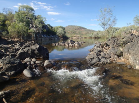
Flowing west across nearly the entire width of Cape York Peninsula – from the Great Dividing Range to the broad floodplains and wetlands of the Gulf of Carpentaria – water from the Mitchell River supports Indigenous communities in the catchment as well as many other important assets, including high-value commercial and recreational fisheries and many wetlands of national significance. With interest in agricultural expansion and water resource development in the catchment, we need information to determine the extent of its potential impact. Led by Professor Stuart Bunn of Griffith University, researchers on the Hub project assessing the environmental water needs for the Mitchell River have been getting their hands dirty in the catchment this dry season. Field teams have already collected 3000 samples from fish, invertebrates and aquatic plants, which will help identify where in the catchment important fish like barramundi get their energy for growing, and how much floodplain ‘hotspots’ of freshwater primary production contribute to that. Combined with models of how water moves across the floodplain at different times, this research will help predict how changes to the flows due to different development scenarios could affect the fisheries and biodiversity that rely on the Mitchell River.
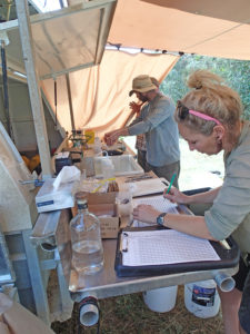
Mitchell River fieldwork, photo Peter Negus.

Mitchell River, photo Peter Negus
Want to know more about the Resilient Landscapes Hub's activities and our research into practical solutions to environmental problems? Stay informed about activities, research, publications, events and more through the Hub newsletter.
"*" indicates required fields