Natalie Stoeckl
Key researcher
University of Tasmania
12 April 2022
Planning for changes and future developments along Australia’s extensive coast presents many challenges. With climate change increasing the hazards for coastal infrastructure and communities (1), there is a need to adapt planning to explicitly assess risk when evaluating development permits. Planning for changing coasts has largely fallen to local government, which may be insufficiently resourced and not have the statutory controls and detailed mapping to refuse developments in high-risk areas.
Coastal-zone planning is a natural extension of regional planning but with a particular focus on the coastal zone. This requires consideration of land–sea relationships and the integration of multiple objectives, threats and actions across these realms. Coastal-zone planning will also often naturally guide development decisions and consider cumulative impacts of threats across realms. It may be considered an extension of cumulative impact assessment (CIA). The distinguishing factor between these regional planning approaches will therefore be the spatial location of planning (coastal zones) and the purpose of the planning. For example, evaluating or guiding singular types of developments may be CIA, while spatial land-and-sea planning that considers multiple uses will require coastal-zone land–sea planning (2).
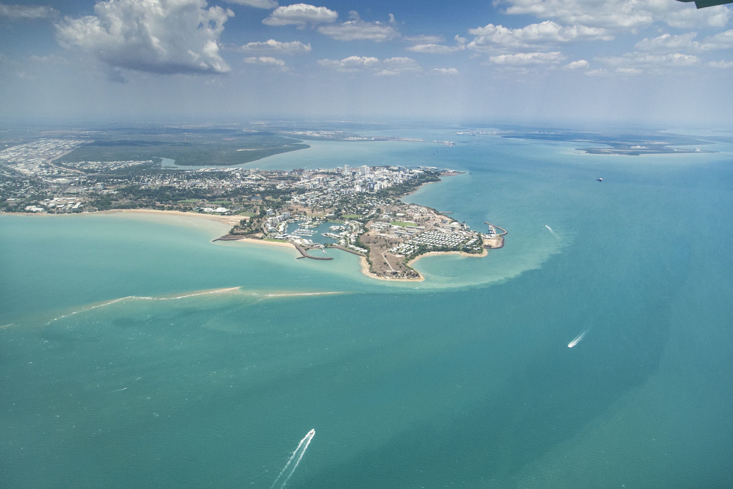
Places such as Darwin Harbour are good candidates for coastal-zone planning. Photo: Patch Clapp.
Despite the long history of integrated coastal-zone management in Australia, the political struggle associated with incorporating climate-change adaptation measures into statutory planning tools remains (3). Planned coastal retreat is a significant challenge and one that local government may not be equipped to deal with (4). Tools such as transferable development rights may need to be adopted when coastal infrastructure can no longer be used for its original purpose (5). Financing nature-based solutions and other innovative approaches, such as transferable development rights, can be integrated into coastal-zone planning to address these challenges.
Coastal-zone regulation has tended to evolve by stacking specific legislation and regulatory provisions onto the planning system (6). For example, Tasmania’s State Coastal Policy 1996, which regulates some developments in coastal areas, takes precedence over local planning schemes (7). The Victorian Coastal Strategy 2014 also has statutory teeth by informing local and regional strategies and plans. As coastal-zone planning progresses, revisions to policies and acts may be required at the state and federal level to support meaningful coastal-zone planning and implementation.
The coastal zone is the zone in which the terrestrial, freshwater and marine realms mix. It is often heavily populated by residences and equally often contested for developments such as ports and shipping. Coastal-zone planning (also often termed cross-realm, ridges-to-reed or catchment-to-coast planning) provides a planning process to guide the spatial allocation of land–sea uses and management actions to achieve explicit environmental and socioeconomic objectives across multiple realms. Failing to account for the social and environmental relationships across these connected realms can result in unintended consequences, including the loss of environmental values and unacceptable impacts to social, economic and environmental values. For example, approving a coastal development in the absence of considering the connection to marine values can result in downstream negative impacts to marine habitats. It could also result in undesirable risks to the development through sea-level rise or storm events that were not planned for. Coastal-zone planning accounts for these spatial dependencies and relationships, and so supports decision-makers in avoiding undesirable consequences. It also facilitates deployment of innovative planning solutions such as nature-based solutions.
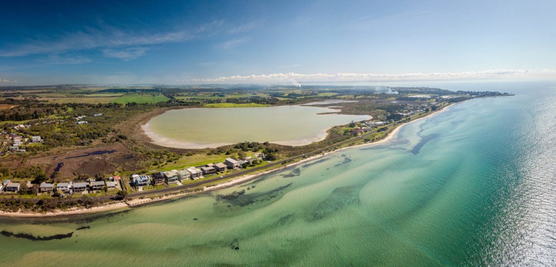
Victoria’s Port Phillip Bay is another good candidate for coastal-zone land–sea planning due to the many different uses. Photo: Nicolas Faramaz.
Existing spatial planning tools such as Marxan have extensions to support the consideration of spatial connectivity across realms and can so be extended to coastal-zone planning. For example, Marxan has been used to plan for land and sea conservation and development in a range of countries and contexts (2, 8).
Coastal-zone planning will result in integrated land and marine planning products that specify where and how resources can be best used. This will include both development of resources and protection of resources for a range of uses (e.g. residential, recreational, environmental protection). Integrated planning will also allow for the deployment of nature-based solutions, such as using wetlands to provide protection to residential zones, as well as considering areas that will need to be identified for planned retreat due to sea-level rise and other climate-change hazards.
These summaries are works in progress and you can contact Dr Vanessa Adams if you have constructive feedback on these summaries.
Want to know more about the Resilient Landscapes Hub's activities and our research into practical solutions to environmental problems? Stay informed about activities, research, publications, events and more through the Hub newsletter.
"*" indicates required fields