12 June 2022
A huge 3D map of the Martuwarra (Fitzroy River) catchment has been handed over to Fitzroy Valley District High School to become part of their Two-Way Science curriculum.
There was a buzz of excitement around the Fitzroy Valley District High School late in 2021 when Hub researchers arrived to provide professional development for teachers on using the 3D map of the Martuwarra catchment.
Traditional Owner adults and school children from nine different language groups built the 3D map in 2017–18. NESP research supported Indigenous land managers of the Martuwarra and scientists from CSIRO and James Cook University to co-develop a new way of displaying digital data onto the 3D surface. Lighting up the 3D map with digital data about native title, language areas, cultural values, water flows, floods, fires, pastoral stations, and more allowed Traditional Owners to show their knowledge in new ways. It helped them to share ideas about plans and decisions for the future of the Martuwarra.
Above all, Traditional Owners found the 3D map useful for passing information across generations. The Hub supported their decision to give the 3D map to the Fitzroy Valley District High School.
When were we building the 3D map, there was lots of learning going on between young and old – it was fantastic. The catchment and the way the river flows is not taught too well to our kids – we learn about other river systems, but not ours. This is our teaching tool. It fulfilled my vision to have it as a teaching tool. We are working together with science and language teachers and Indigenous ranger programs in schools using an integrated approach. The map will be a great tool.
– Marmingee Hand, Program Manager, Aboriginal and Islander Education for the school (and part of the Traditional Owner team who built the 3D map)
Marmingee explained that the Martuwarra Fitzroy River Council members were meeting in Fitzroy Crossing at the time and were very excited by the opportunity to see the map.
It’s fantastic to see it and I’m glad that it’s here [at the school].
– Gordon Smith, Council member
We need to record you, telling the stories and all the layers – thankyou, this is very powerful.
– Fitzroy Valley District High School teacher
Not everything went to plan with the professional development session – some technological hitches meant the digital display didn’t work properly at first.
The science and maths teachers really engaged in problem-solving, so we felt in the end it was not a bad thing – they really took ownership of making it work!
– Nat Raisbeck-Brown, CSIRO researcher
The research team produced a comprehensive guide, the Martuwarra (Fitzroy River) catchment 3-dimensional map manual, for the professional development session and have since updated it based on the teachers’ feedback. The 3D map manual provides all the information that teachers, Traditional Owners, parents and students need to use the 3D map.
Further information about the project is available from the Hub website Knowledge brokering for Indigenous land management .
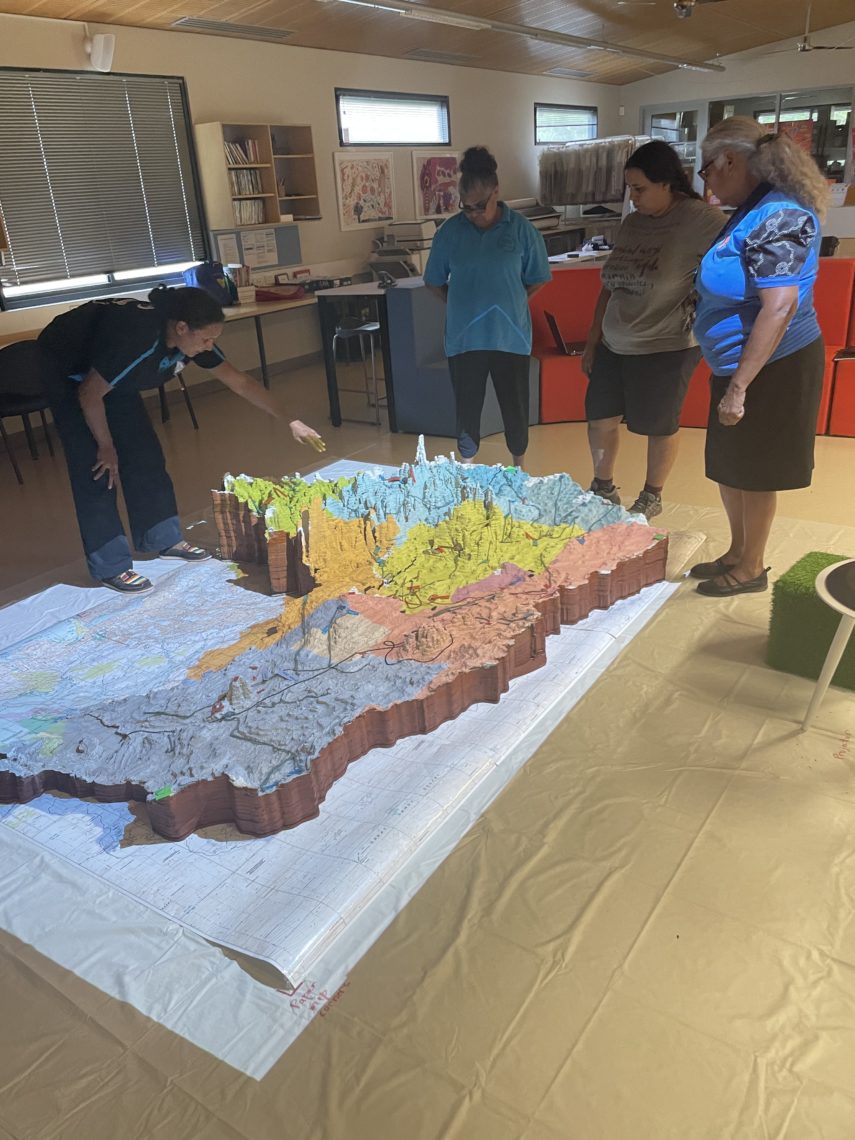
Teachers discussing Native Title determinations displayed on the 3D map.
From left: Amarillo Oscar, Jocelyn McCarthy, Natalie Davey, Marmingee Hand
Want to know more about the Resilient Landscapes Hub's activities and our research into practical solutions to environmental problems? Stay informed about activities, research, publications, events and more through the Hub newsletter.
"*" indicates required fields