25 November 2025
Research Update
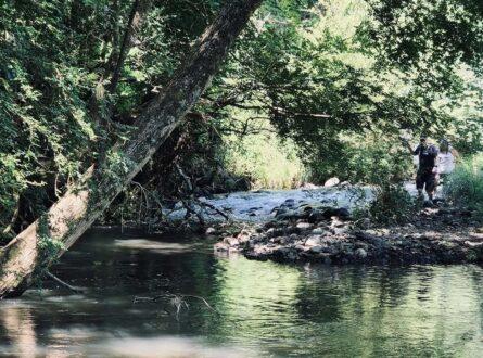
The Northern Rivers region of NSW spans more than 3 million hectares across the Tweed, Brunswick, Richmond, and Clarence catchments. It is one of Australia’s most biodiverse landscapes, supporting a high number of endemic and threatened species. Conservation work here involves a wide network of government agencies, community organisations, Indigenous groups, and private landholders.
Over the past six months, our team has been working closely with the region’s conservation community to build their capacity to undertake climate adaptation planning for biodiversity. This work centred on a series of six adaptation planning workshops, attended by around 45 participants per session, representing local and state government, conservation NGOs, Landcare groups, Indigenous organisations, private landholders, and community-based conservation groups.
Building a Shared Understanding of Climate Risk
The workshop series was shaped by six core objectives: to improve participants’ understanding of the IPCC approach to climate risk; strengthen collaboration across organisations and sectors; examine emerging conservation principles for biodiversity under a changing climate; provide hands-on experience with spatial data analysis tools; build practical skills for planning under uncertainty; and support the use of customised tools and methodologies developed specifically for this project.
To support this process, the research team developed a suite of custom-designed tools and resources, including:
These tools were designed specifically for the Northern Rivers context to ensure that planning decisions were grounded in local knowledge, relevant science, and region-specific climate projections.
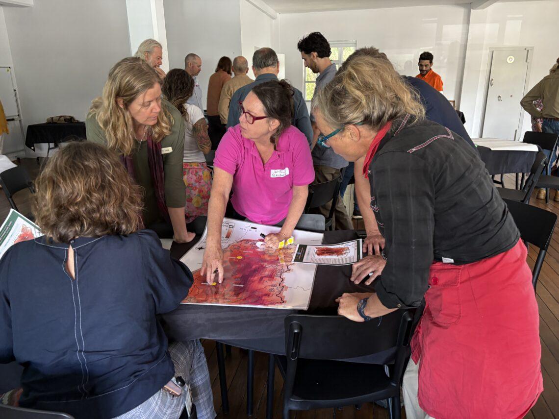
Northern Rivers workshop. Photo Pazit Taygfeld
Workshop Series at a Glance
Workshops 1 & 2 – Understanding Climate Risk
Participants were introduced to the IPCC climate risk assessment framework. The participants used the seven climate hazard maps to explore how these vary geographically across the region, relate them with local knowledge, and identify priority areas of concern.
Workshop 2:
Using a trait-based approach, participants evaluated the sensitivity, adaptive capacity, and exposure of a set of ~40 priority species to the seven climate hazards. This process led to the selection of eight focal species for deeper adaptation planning.
Workshops 3 & 4 – Developing and Testing Adaptation Options
Participants identified observed and potential climate-related impacts on the eight focal species and proposed adaptation actions aimed at reducing each species exposure or sensitivity, or enhancing their adaptive capacity.
These adaptation options were tested against two plausible future socio–ecological scenarios to explore their feasibility and robustness. The research team then synthesised results into a final set of robust, conditional, transformational, and foundational actions.
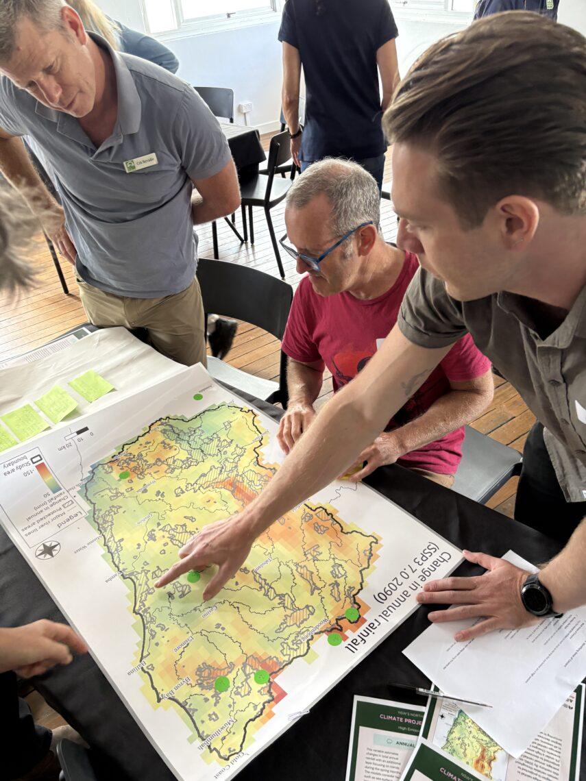
Northern Rivers workshop. Photo Pazit Taygfeld
Workshop 5 – Building Adaptation Pathways
In this workshop participants worked in species-based groups to identify necessary and feasible adaptation options and to sequence these through time, identifying potential trigger points, tipping points, dependencies, and contingency options. This exercise helped establish clear pathways for how management actions may need to evolve under changing climate conditions.
Workshop 6 – Applying Spatial Tools for Decision Support
The final workshop focused on the practical use of the spatial decision support tool MCAS-S (Multi-Criteria Analysis Shell for Spatial Decision Support).
Participants worked with the customised MCAS-S dataset which comprised the climate hazard projections, species potential distribution models, habitat connectivity layers, and land tenure information. MCAS-S enabled the participants to analysis these data sets and identify spatial priorities, detect gaps, and explore where adaptation actions could be most effective across the landscape.
What’s Next
The insights, maps, pathways, and datasets produced through this process are now being compiled into a suite of adaptation planning resources. These will support ongoing decision-making across the region and strengthen collaborative efforts to build biodiversity resilience under a changing climate.
Want to know more about the Resilient Landscapes Hub's activities and our research into practical solutions to environmental problems? Stay informed about activities, research, publications, events and more through the Hub newsletter.
"*" indicates required fields