9 November 2026
Persistent pools, also known as waterholes, occur in rivers and floodplains. They are important refuges for biodiversity and cultural values. They are becoming even more important as climate change makes dry periods longer and more severe.
Persistent pools can change over time. Their location and shape can shift as rainfall and river flows change. This makes them hard to define and monitor.
Researchers at the NESP Resilient Landscapes Hub are developing remote-sensing tools to map, track and predict changes in persistent pools. The work uses satellite data from Landsat, Sentinel and PlanetScope.
The tools will help research users make better decisions about water planning and climate adaptation. They will also help protect important refuges in non-perennial river systems.
Research users include water and environment agencies in Queensland, Western Australia and Victoria. They also include DCCEEW and Geoscience Australia.
The project began with a case study in Queensland. The next phase will focus on the National Heritage Listed Martuwarra Fitzroy River catchment.
This phase was developed with the Martuwarra Fitzroy River Council. It recognises the importance of “living waters” and culturally significant pools for Traditional Owners. It also applies the project tools in a river system of national importance.
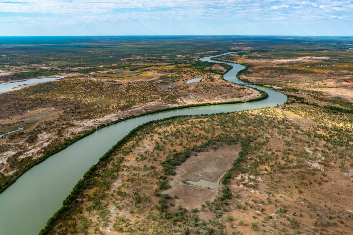
Waterholes from the Gulf region (photo credit: Michael Douglas).
“Waterholes are important to sustainable water management in Queensland’s many intermittently flowing rivers as they are vital elements of their ecosystems. Knowing where they are is critical and the new framework advances the approach used to map their locations for use in water planning.” – Dr Jonathan Marshall, Queensland Government.
A new ‘mapping resilience’ tool is now available
A major early outcome from this Hub project is a published, data-driven geospatial framework. The framework brings together satellite images, rainfall records and river flow data. It shows where surface water occurs and which pools persist over time.
The method is low-cost, repeatable and easy to use in other catchments. It helps governments and research agencies find drought refuges and track change using open data.
Proven in practice on the Gilbert River
The approach was tested across a 100 km stretch of the Gilbert River in Queensland. It used data from 1986 to 2023.
The framework identified 29 persistent pools. The study showed that these pools are not permanent. Their size and persistence change over time.
Pool persistence was strongly linked to wet-season rainfall and how long the river stops flowing. This gives practical evidence for water planning and targeted conservation action.
“Previous waterhole mapping has assumed waterholes are always in the same places in the river network,” says Dr Jonathan Marshall, Queensland Government. “However, in changeable rivers like the Gilbert used in the study, waterholes move from year to year as the sandy riverbed changes. For the first time, this new framework allows us to include shifting, dynamic waterholes in water planning.”
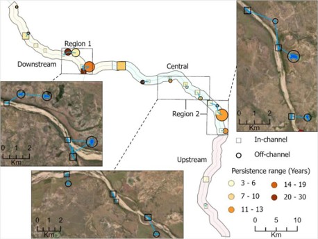
Satellite-derived map showing persistent pool locations/extent for the Gilbert River case study (image credit: authors / Journal of Hydrology).
By turning open data into clear maps, the framework helps decision-makers protect freshwater ecosystems as dry periods become longer and more common. It also helps identify and track the waterholes that support wildlife, local livelihoods, food production and cultural heritage.
Further reading
Mapping resilience: A framework for analysing surface-water dynamics and persistent pools in non-perennial rivers using remote sensing, rainfall and river discharge data.
Want to know more about the Resilient Landscapes Hub's activities and our research into practical solutions to environmental problems? Stay informed about activities, research, publications, events and more through the Hub newsletter.
"*" indicates required fields