Thiaggo Tayer
Data Wrangler
The University of Western Australia
Start date: 02/02/2025
End date: 30/06/2027
NESP funding: $590,000 (GST-exclusive)
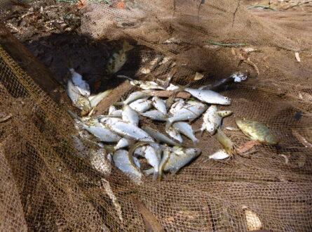
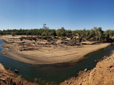
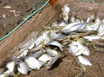
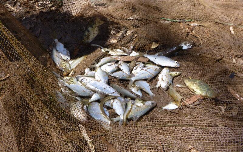
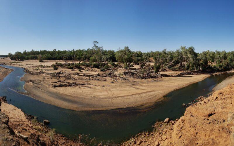
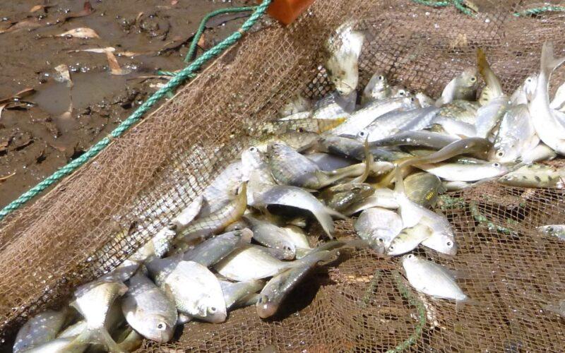
This project focuses on developing innovative tools using satellite imagery to map and monitor persistent pools (waterholes) within Australian rivers and floodplains. Persistent pools are vital water resources, especially under climate change and growing water use. They are crucial for ecosystems, providing habitats for species, sustaining ecological processes and serving as refuges during dry periods. The project will use satellite data from Landsat, Sentinel and Planetscope to map these pools, assess their dynamics, and predict future changes under various climate and water-use scenarios. The findings will support sustainable management strategies, including water allocation, climate adaptation and conservation efforts, with case studies in the Martuwarra Fitzroy River (WA), Gilbert River (Qld) and the Ovens River in Northern Victoria.
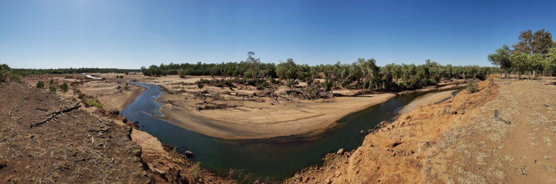
Persistent pools are challenging to map due to their dynamic nature, shifting with changes in flow and precipitation. Current methods do not adequately capture these fluctuations, leading to potential underestimation of the area of persistent pools. The increasing demand for water resources, combined with climate change, underscores the need for better mapping and monitoring techniques. Remote sensing offers an efficient, cost-effective way to track these dynamic features across large areas, providing historical and real-time data to inform management decisions. This project aims to fill the gap in current methods by integrating data from multiple satellites and analysing the ecological and socio-cultural implications of pool dynamics.
Key research areas
This project aims to:
The results will be used to identify vulnerable pools and inform conservation strategies, with outputs including spatial datasets, vulnerability maps and an automated analytical algorithm for spatiotemporal analysis.
Pathway to impact
This project will:
Scientific Paper
April 2026 | Open Access
Young-of-year fish occupy floodplain pools across life-history strategies despite brief and variable river−floodplain connectivity
Pratt OP, Beesley LS, Keogh CS, Pusey BJ, Setterfield SA, Douglas MM. (2026) Young-of-year fish occupy floodplain pools across life-history strategies despite brief and variable river−floodplain connectivity. Marine & Freshwater Research 77, MF25178. https://doi.org/10.1071/MF25178
Scientific Paper
January 2026 | Open Access
Mapping resilience: A framework for analysing surface-water dynamics and persistent pools in non-perennial rivers using remote sensing, rainfall and river discharge data
Thiaggo C. Tayer, Leah S. Beesley, Ben Stewart-Koster, Nick Bond, Michael M. Douglas, Maria J. Rossi, Glenn B. McGregor, Jonathan C. Marshall, Mapping resilience: A framework for analysing surface-water dynamics and persistent pools in non-perennial rivers using remote sensing, rainfall and river discharge data, Journal of Hydrology, Volume 666, 2026, 134750, ISSN 0022-1694, https://doi.org/10.1016/j.jhydrol.2025.134750
Scientific Paper
November 2025 | Open Access
Large, prolonged flooding and pool persistence promote floodplain fish diversity in a threatened river
Pratt, Oliver P., Leah S. Beesley, Daniel C. Gwinn, Thiaggo C. Tayer, Bradley J. Pusey, Chris S. Keogh, Samantha A. Setterfield, and Michael M. Douglas. 2025. “ Large, Prolonged Flooding and Pool Persistence Promote Floodplain Fish Diversity in a Threatened River.” Ecological Applications 35(7): e70155. https://doi.org/10.1002/eap.70155
Scientific Paper
November 2025 | Open Access
Eating In or Out? Terrestrial Contributions to the Diet of Australian Freshwater Fish
Pusey, B. J., M. J. Kennard, L. S. Beesley, T. W. Ho, A. M. Davis, and M. M. Douglas. 2025. “ Eating In or Out? Terrestrial Contributions to the Diet of Australian Freshwater Fish.” Freshwater Biology 70, no. 11: e70129. https://doi.org/10.1111/fwb.70129.
Info Sheet
May 2025
Mapping and monitoring persistent pools (info sheet)
Project leaders
This project is led by Thiaggo Tayer of The University of Western Australia and Ben Stewart-Koster of Griffith University.
Contact
For further information contact thiaggo.tayer@uwa.edu.au, b.stewart-koster@griffith.edu.au or nesplandscapes@uwa.edu.au.
Research users
People
Data Wrangler
The University of Western Australia