Matt Hayward
Research Executive Committee and Key Researcher
University of Newcastle
Project start date: 01/07/2022
Project end date: 31/03/2026
NESP funding: $51,000 (GST-exclusive)
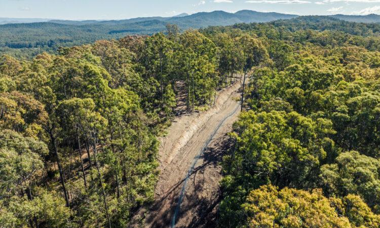
Safe havens are an important conservation tool for protecting threatened species from invasive predators and other pests. They include fenced areas, islands where predators have been removed, fenced peninsulas, private conservation reserves, sanctuaries and some national parks.
This project assessed how well Australia’s current safe-haven network protects threatened non-mammalian fauna, including birds, reptiles, amphibians, fish and invertebrates. It also identified where future safe havens could provide the greatest conservation benefit under climate change.
The research found that Australia’s current mainland fenced safe-haven network offers limited protection for threatened non-mammal species. Many existing safe havens were originally designed to protect mammals from cats and foxes but threatened non-mammal species face a wider range of threats, including rats, pigs, trout, weeds, pathogens and problematic native species.
The project used species distribution modelling and spatial prioritisation to identify high-value areas for future safe havens. These priority areas can help guide investment in new or adapted safe havens that are designed around the threats faced by different species.
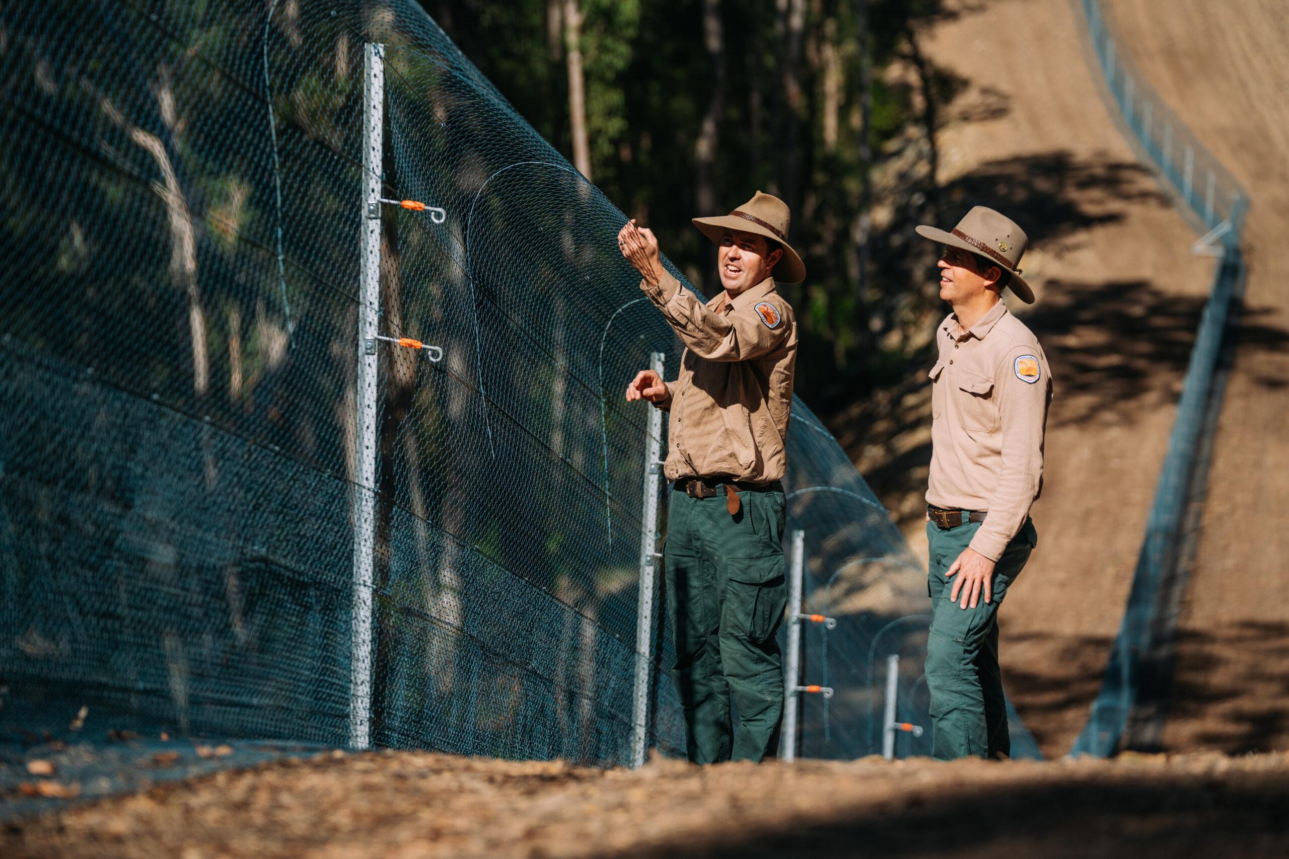
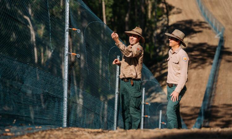
Department of Climate Change, Energy, the Environment and Water ecologist Matt Dobson and New South Wales National Parks and Wildlife Service Coffs Coast Area Manager Andrew Pitzen assessing an area of the Ngambaa Nature Reserve fence. Photo: Remy Brand.
The project found that Australia’s current mainland fenced safe-haven network provides limited protection for threatened non-mammal species.
Key findings include:
These findings show that improving protection for threatened non-mammal species will require careful planning of where safe havens are located, which species they target, and what threats they are designed to manage.
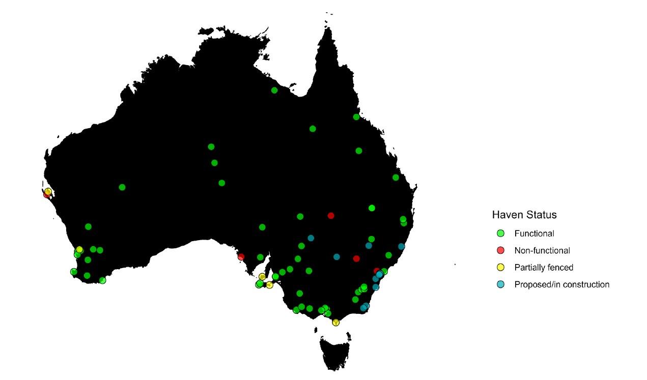
The project identified 74 mainland fenced safe havens across Australia, including functional, non-functional, partially fenced and proposed sites. Image: Gould et al. 2026 / Biological Conservation.
Interactive map showing priority areas for inclusion in Australia’s safe haven network under different pest/threat scenarios. Priority areas are based on the study’s spatial modelling outputs and should be interpreted as indicative broad priority locations rather than exact site boundaries. Fenced safe haven location markers show haven status as functional, partially fenced, or proposed/in construction.

Scientific Paper
June 2026 | Open Access
Extending the protection offered by safe haven networks to threatened non-mammalian fauna
Gould, J., Southwell, D., Griffin, A. S., Moseby, K., Legge, S., & Hayward, M. W. (2026). Extending the protection offered by safe haven networks to threatened non-mammalian fauna. Biological Conservation, 321, 111973. https://doi.org/10.1016/j.biocon.2026.111973
Report
November 2024
Resilient Landscapes Hub 2023 Annual Progress Report
Report
June 2023
Resilient Landscapes Hub 2022 Annual Progress Report
Other
July 2022
Resilient Landscapes Hub 2021 Annual Progress Report
Project leader
This project was led by Professor Matt Hayward from the University of Newcastle.
Project team members included Darren Southwell, Andrea Griffin and John Gould from the University of Newcastle, with collaborators Katherine Moseby and Sarah Legge contributing to the published research.
Contact
For further information, contact matthew.hayward@newcastle.edu.au or nesplandscapes@uwa.edu.au.
Research users
People
Research Executive Committee and Key Researcher
University of Newcastle