Jim Smart
Griffith University
Keywords: Environmental, environment, environmental values, environmental economic accounting, enviro-economic accounting, EEA, EEAs, EEA framework, ecosystem assets, ecosystem services, asset interconnections, northern Australia, Mitchell River catchment, Queensland, Queensland Department of Environment, Griffith University
Environmental economic accounts are a way to integrate environmental and economic information about an area to better understand the relationships between the environment and the economy, particularly how environmental contributions benefit humanity.
The United Nations’ System of Environmental Economic Accounting – Ecosystem Accounting (SEEA EA) provides a framework for organising data about habitats and landscapes, measuring ecosystem services, tracking changes in ecosystem assets, and linking this information to economic and other human activity.
This project used the SEEA EA framework to develop a set of pilot ecosystem accounts for the Mitchell River catchment in Far North Queensland.
Read more in the project’s final report, methodology report and data inventory.
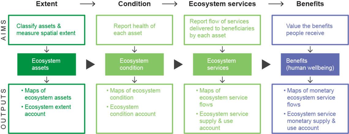
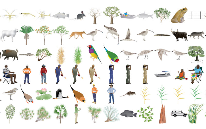
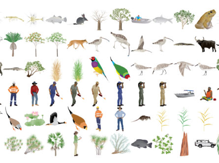
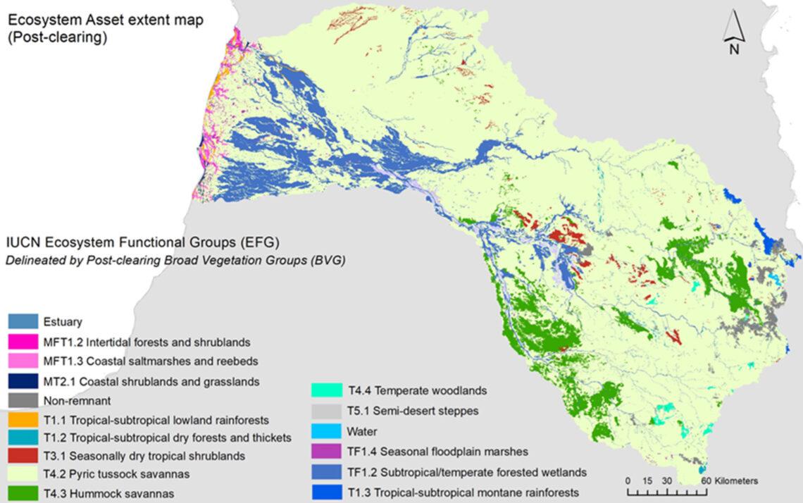
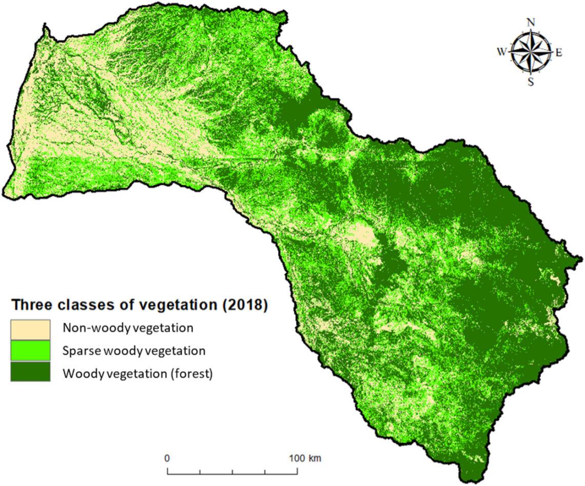
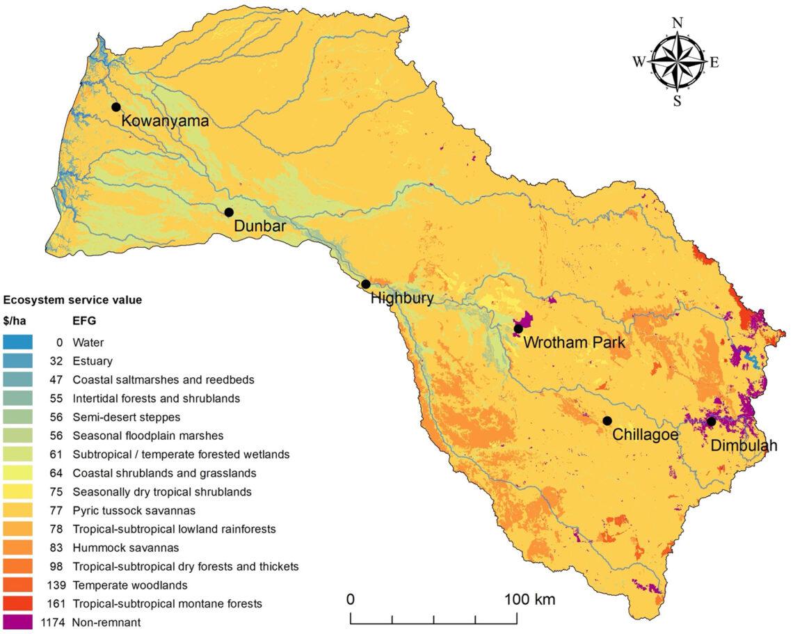
Layout of the ecosystem accounts for the Mitchell River catchment.
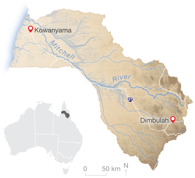
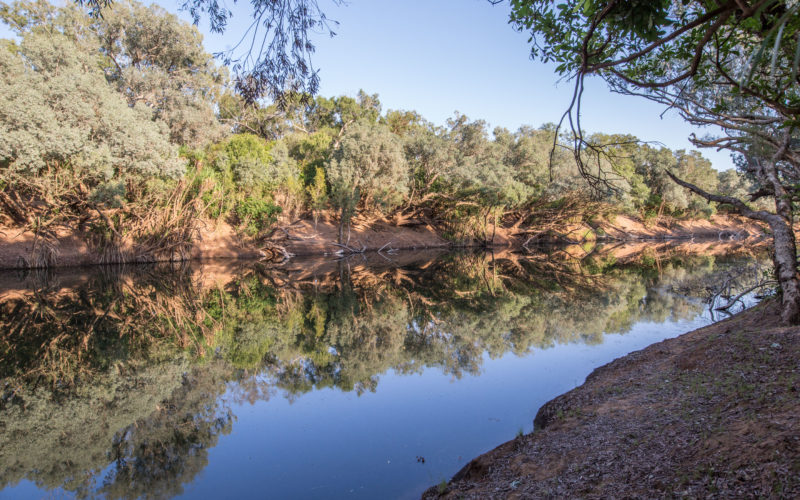
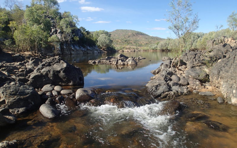
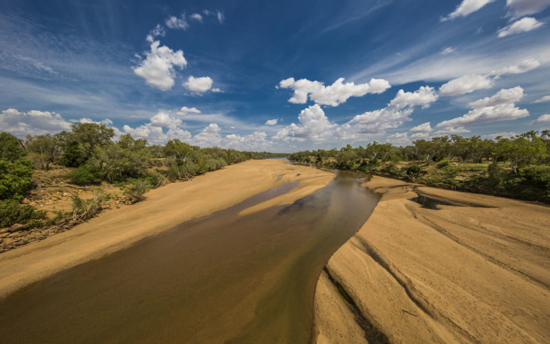
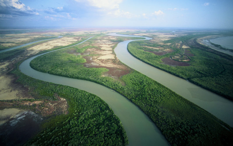
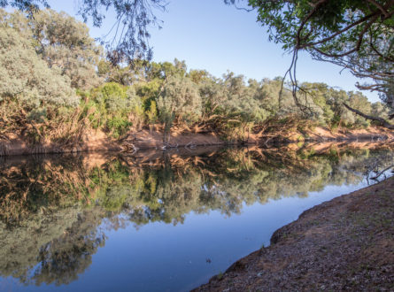
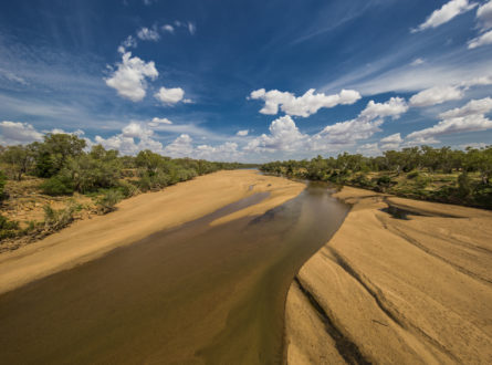
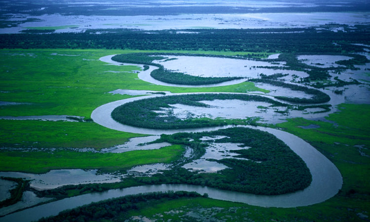
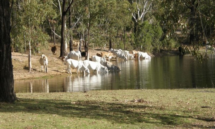
The Mitchell River is located in Far North Queensland and flows into the Gulf of Carpentaria. Image: Resilient Landscapes Hub.
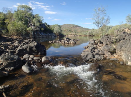
For tens of thousands of years prior to European invasion and settlement, the ancestors of today’s Traditional Owners of the Mitchell River catchment socialised the landscapes of the region as they managed land and water, fulfilled custodial responsibilities under customary law and maintained an economic system that sustained their way of life. This active management by Traditional Owners continues in many localities today, albeit under constrained conditions.


Scientific Paper
January 2023 | Open Access
Ecosystem services in connected catchment to coast ecosystems: monitoring to detect emerging trends (scientific paper)
Brown CJ, Saint Ange C, Connolly RM, Hasan S, Jackson S, McMahon JM and Smart JCR (2023) ‘Ecosystem services in connected catchment to coast ecosystems: monitoring to detect emerging trends’, Science of the Total Environment 161670, https://doi.org/10.1016/j.scitotenv.2023.161670.
Report
July 2022
Environmental economic accounting for interconnected assets and ecosystem services in the Mitchell River catchment, Queensland: Pilot ecosystem accounts and supporting information (final report)
Smart, J.C.R., Hasan S., Curwen G.R., Saint Ange C., Dyke J., McMahon J.M., Jackson S., Barber M., Sinnamon V., Brown C.J., Burns G.L., Fleming C.M., Connolly R.M., Burford M.A. (2022) Environmental economic accounting for interconnected ecosystem assets and ecosystem services in the Mitchell River catchment, Queensland: Pilot ecosystem accounts and supporting information, Griffith University, Brisbane.
Report
July 2022
Environmental economic accounting for interconnected ecosystem assets and ecosystem services in the Mitchell River catchment, Qld (methodology report)
Smart, J.C.R., Hasan S., Dyke J., Sinnamon V., Jackson S., Barber M., McMahon J.M., Brown C.J., Curwen G.R., Saint Ange C., Burns G.L., Fleming C.M., Connolly R.M., Burford M.A. (2022) Environmental economic accounting for interconnected ecosystem assets and ecosystem services in the Mitchell River catchment, Queensland: Technical report – Methodology. Griffith University, Brisbane.
Report
July 2022
Environmental economic accounting for interconnected ecosystem assets and ecosystem services in the Mitchell River catchment, Qld (data inventory)
Curwen G. R., Saint Ange C., Dyke J. and Hasan S. (2022) Environmental economic accounting for interconnected ecosystem assets and ecosystem services in the Mitchell catchment, Queensland: Data Inventory. Griffith University, Brisbane.
Scientific Paper
July 2022
Challenges in modelling the sediment retention ecosystem service to inform an ecosystem account – examples from the Mitchell catchment in northern Australia (scientific paper)
McMahon JM, Hasan S, Brooks A, Curwen G, Dyke J, Ange CS, Smart JCR. (2022) ‘Challenges in modelling the sediment retention ecosystem service to inform an ecosystem account – examples from the Mitchell catchment in northern Australia’, Journal of Environmental Management 314:115102, https://doi.org/10.1016/j.jenvman.2022.115102.
Report
July 2022
Northern Hub Final Report 2021
Northern Australia Environmental Resources Hub. 2021. Northern Australia Environmental Resources Hub Final Report. Charles Darwin University, Darwin.
Info Sheet
August 2021
Mitchell River story map (start-up factsheet)
Impact Storie
May 2021
Engagement is a two-way street: Creating symbols for science communication (impact story 2020)
Other
March 2021
More Than Words (CSIRO Double Helix article Jan 2021)
Info Sheet
February 2019
Environmental-economic accounting for the Mitchell River catchment (start-up factsheet)
Presentation
April 2018
Environmental-economic accounting for interconnected ecosystem assets and ecosystem services in the Mitchell catchment (presentation)
Other
May 2017
North Queensland research overview (brochure Mar 2019)
This project is led by Dr Jim Smart from Griffith University.
Dr Smart is being assisted by researchers from Griffith University and CSIRO as well as by land managers, rangers and others in the Mitchell River catchment.
This project is due for completion in June 2021.
Contact
Jim Smart, Griffith University
j.smart@griffith.edu.au
![]()
![]()
Griffith University
Griffith University
Griffith University
Key Researcher
Griffith University
CSIRO
Research Executive Committee and Eastern Node Leader
Griffith University