Justin Perry
NAILSMA
18 February 2021
Teaming up for turtles
Cloud and AI automate and accelerate turtle nest monitoring and predator tracking, allowing Indigenous rangers from Cape York to take swift, smart action.
See Microsoft’s media release with more images, feature story and read Minister Ley’s media release.
A world-first AI-infused cloud-based system that can quickly analyse thousands of aerial photographs of remote beaches in northern Australia to identify evidence of both turtle nests and their predators has been developed by CSIRO, Aak Puul Ngantam (APN) Cape York Indigenous rangers and Microsoft as part of a National Environmental Science Program (NESP) partnership.
In some parts of western Cape York, in far north Queensland, feral pigs can dig up and eat 100 per cent of turtle nest eggs – for the 50km stretch of beach that is the focus of APN’s protection program, this represents a loss of around 2,000 baby turtles each year.
Automating and accelerating turtle nest monitoring gives Indigenous rangers the best chance of protecting nests, controlling predators and helping increase the chance of Hawksbill, Flatback and Olive Ridley turtle hatchling survival.
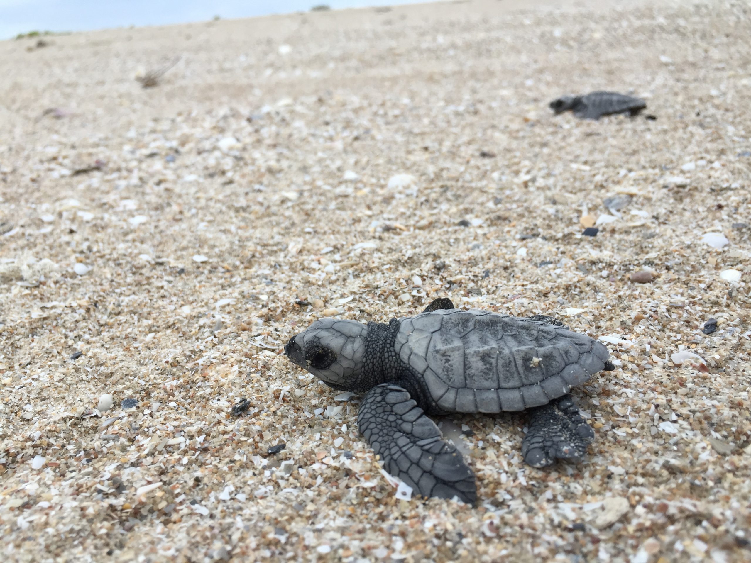
A turtle hatchling heads to the sea, and a brighter future. Photo courtesy APN Cape York archive.
With this system, what normally takes one month of on-the-ground monitoring work can be achieved in just two hours using a helicopter or drone combined with cloud computing and AI.
Australia’s Minister for the Environment, Sussan Ley MP, welcomed the use of drone and AI technology to bring about environmental solutions.
This makes a real difference to the work Indigenous rangers are doing in Australia’s remote far north to protect turtle nests from feral predators and to help species such as the Hawksbill, Flatback and Olive Ridley turtles make it from the nest to the ocean. This project is just one of many examples of how the Australian Government’s $294 million National Environmental Science Program is continuing to support science-based solutions to environmental issues.
– The Hon Sussan Ley, Minister for the Environment
There are only seven species of marine turtle on the planet, and six of them are considered threatened due to a combination of human, environmental and predator threats.
While turtle is one of many traditional food sources for coastal communities of Indigenous people, they have always been consumed at a sustainable level. Feral pigs however can decimate turtle populations if left unchecked.
Some control methods have been shown to reduce feral pig predation of turtle nests by as much as 90 per cent. But there are three big challenges for rangers managing these control programs: accessing remote beaches, knowing where nests are being attacked by predators, and when.
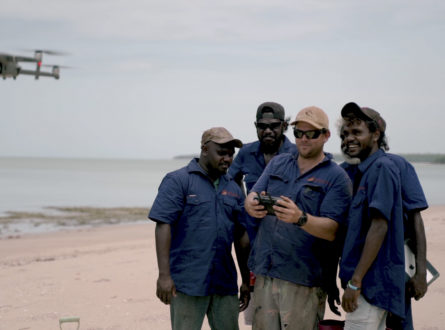
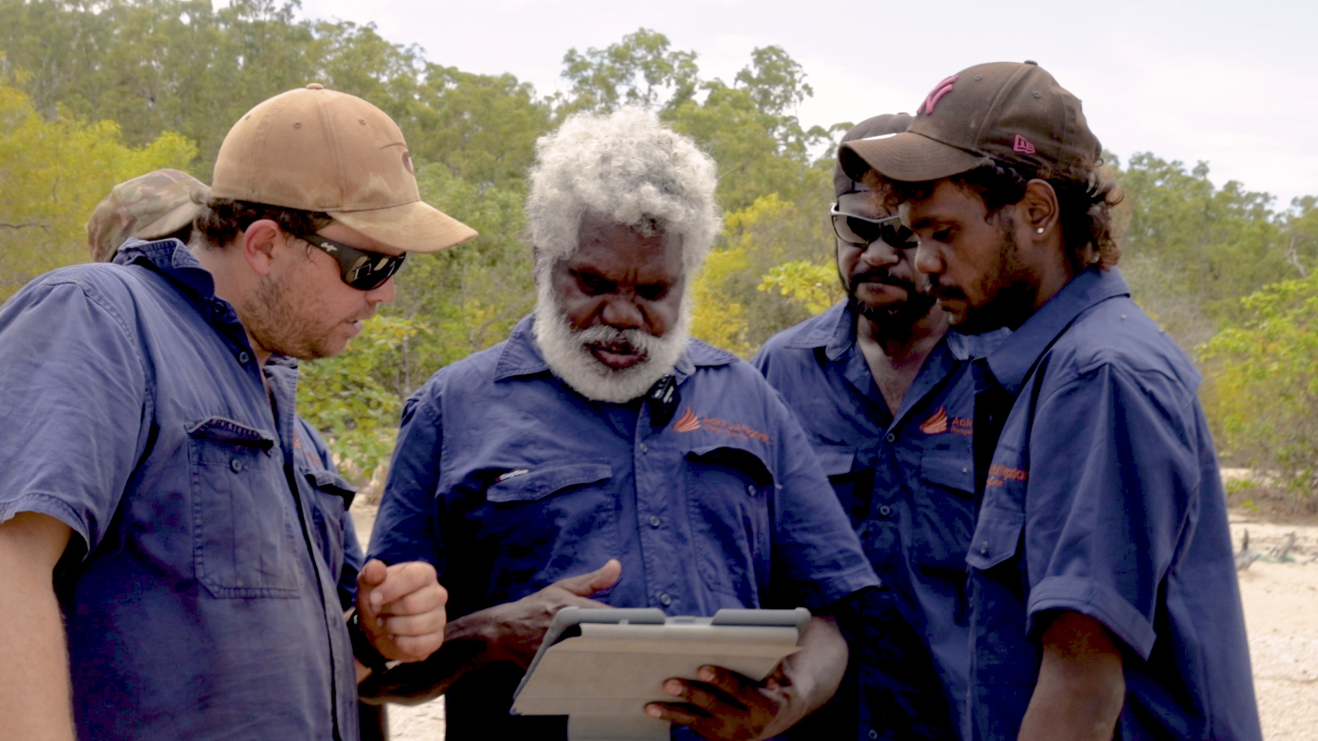
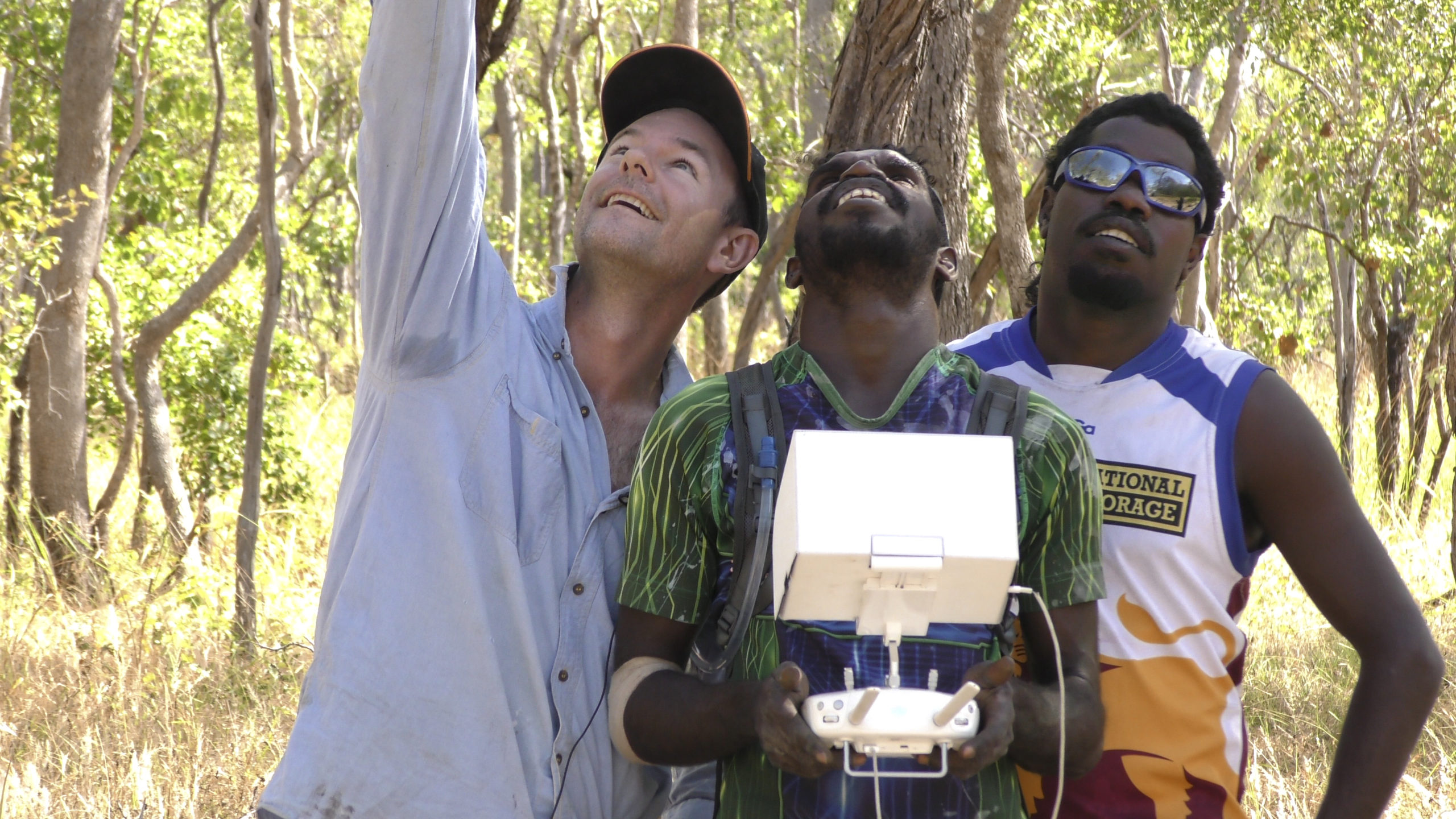
Working together as part of a NESP Northern Australia Environmental Resources Hub project and with the support of Microsoft’s AI for Earth program, APN Cape York, CSIRO and Microsoft are using Indigenous knowledge, drone and helicopter-collected photographs, cloud computing and artificial intelligence (AI) to identify turtle and predator tracks on remote beaches. Having more immediate and complete data will allow rangers, scientists and Indigenous leaders to work together on initiatives to more effectively manage nest predators and protect turtle populations.
Real-time insights help APN Cape York rangers adaptively manage the region. Photo by Phisch Creative – Phil Schouteten.
It can prove impossible to get to the turtle beach until late July or August after a wet season, when the waist deep, 100-metre wide floodplain is too boggy to traverse. That is long after the peak nesting period which begins in June.
Rangers wanted to be able to monitor the beach earlier to protect the nests which are most vulnerable in the first few days after the eggs are laid – this is when the female turtle’s tracks are still visible to predators and when the scent of her freshly laid eggs is strongest.
To speed up the process, CSIRO approached Microsoft to see whether AI could help identify relevant information quickly from the tens of thousands of survey images, to pinpoint locations where there was evidence of turtle nesting and predator activity (by identifying animal tracks).
Through Microsoft’s AI for Earth program Microsoft engineers loaded the images to the Azure cloud, then developed a series of AI-infused image detection algorithms, including a terrain classifier and a track/predator object detector. Both algorithms are showing early promise of detection accuracy, with the terrain classifier exhibiting a +90 per cent accuracy for distinguishing between beach, bush and ocean terrain, and the track/predator object detector incrementally improving its performance based on +45,000 further images processed and trained.
The system has been designed so that data input is simple – rangers simply take the SD card out of the drone or helicopter-mounted camera, upload that content to a folder, and the analysis is then automated in Azure.
The resulting analysis can then be fed into a dashboard, being developed by CSIRO and Microsoft using Power BI. This overlays data collected by rangers using the Nestor app on the ground with the insights collected from the analysis of aerial photographs.
We’re using Microsoft AI to automatically analyse tens of thousands of images for predator tracks and nest location, and sharing the insights with rangers in real time using a Power BI dashboard. We can now monitor twice the length of the coast line in two hours instead of a month. This work has seen 20,000 hatchlings make it to the ocean every season. An entire ecosystem is being stabilised. New technology like AI is playing a vital role to bring turtles back from the brink of extinction.
– Dr Justin Perry, CSIRO Research Scientist
This is really an Indigenous-led threatened species program that’s having quantitative outcomes we can actually measure. Rangers are monitoring not only the number of turtles that are coming in and laying, but also the amount of predation that’s happening and putting into place an adaptive predator control program to make sure that as many nests survive as they can.
– Kerri Woodcock, Biodiversity and Fire Program Manager, Cape York Natural Resource Management
This initiative builds on Healthy Country Partnership work already undertaken by Bininj co-researchers and Indigenous rangers, CSIRO, NESP, Kakadu National Park and Microsoft under Microsoft’s AI for Earth program. Cloud computing and AI have been used in Kakadu National Park to monitor the spread of invasive weeds, providing insights to help Indigenous rangers manage the park and encourage the return of magpie geese.
The latest application of the technology demonstrates that the automation pipeline can be iterated and refined to address many different environmental challenges.
This work reflects the next step toward developing a flexible, adaptive management tool for environmental management.
– Dr Justin Perry
Using this research to target turtle management activities has already reduced predation levels down to under 30 per cent which CSIRO and APN Cape York believe will safeguard a sustainable population of turtles.
The prototype for this was developed in just a few weeks using a range of Azure services by a small Microsoft team working collaboratively with CSIRO and APN Cape York. Together the teams are using machine learning to train and refine the models. The dashboard built by CSIRO and Microsoft overlays the insights from aerial footage onto existing data, allowing rangers on the ground to take rapid informed action to ensure the best outcomes. This is AI in action, AI for good.
– Lee Hickin, Chief Technology Officer, Microsoft Australia
Modern technology and Indigenous knowledge combine to protect the environment. Photo by Brian Ross.
NAILSMA
Want to know more about the Resilient Landscapes Hub's activities and our research into practical solutions to environmental problems? Stay informed about activities, research, publications, events and more through the Hub newsletter.
"*" indicates required fields