10 November 2021
Part of the West Kimberley National Heritage Place, the mighty Martuwarra (Fitzroy River) in Western Australia sustains rich biodiversity, ecosystems and human cultures.
This Northern Australia Hub research project was led by researchers at The University of Western Australia and Griffith University and aimed to determine the environmental water needs of key plants and animals of the Fitzroy – vital information needed to inform water planning for this river that has previously been identified as suitable for water-resource development to support the expansion of irrigated agriculture.

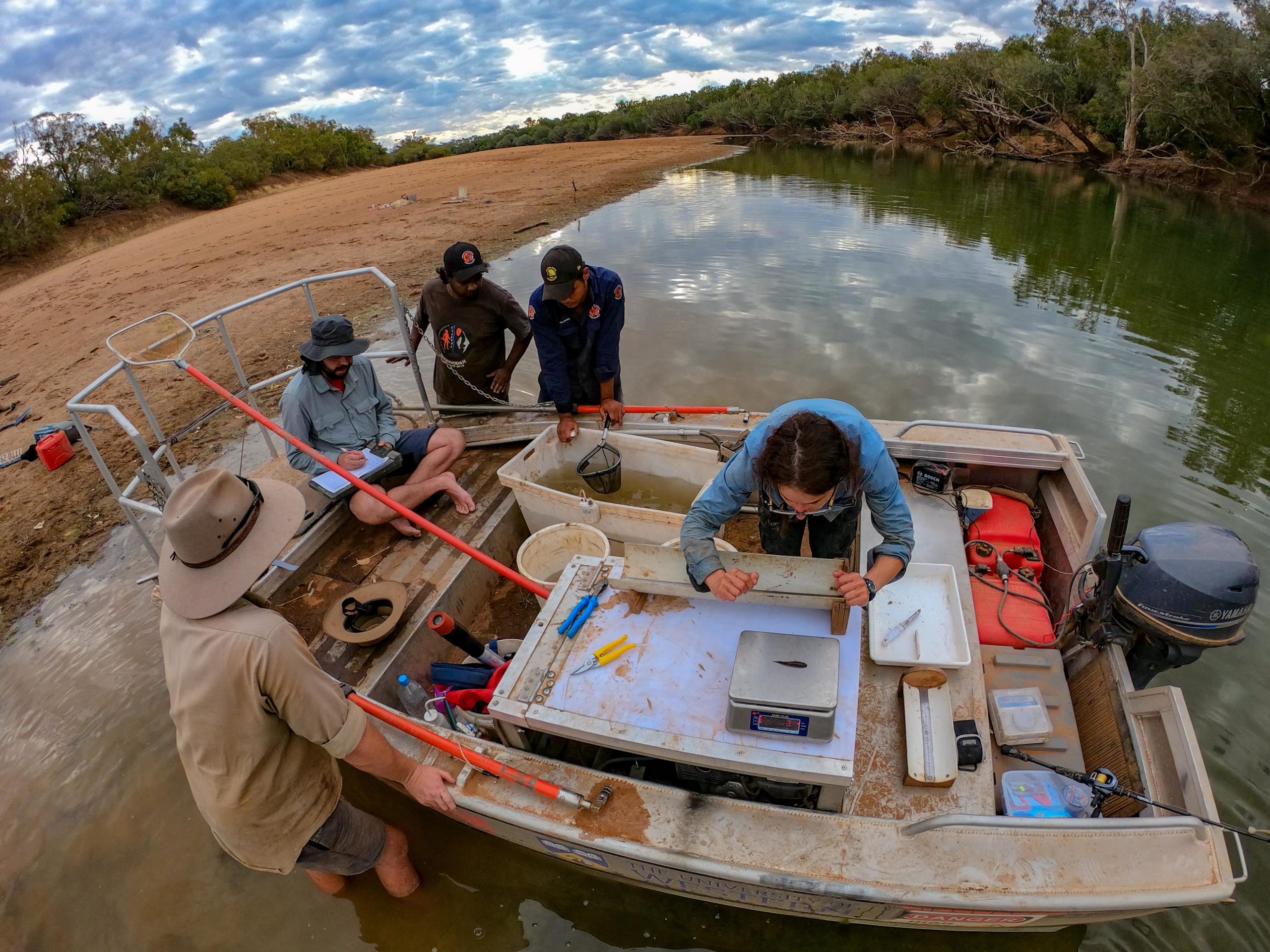
Hub researchers Leah Beesley, Chris Keogh and PhD Student Thiaggo de Castro Tayer sampling fish and algae in collaboration with Yimardoo Warra Rangers Jeremiah Green and Shaquille Millindee. Photo: Michael Douglas.
Conducted in partnership with Traditional Owners and Indigenous rangers, this research has increased our knowledge of riparian vegetation, fish and cherabin, the aquatic food web, water chemistry of pools and hydrological connectivity. For example, modelling various water-take scenarios combined with mapping where riparian trees occurred and new knowledge of how they use water showed the areas and tree species most vulnerable to water extraction.
Conceptual models were also developed which can be used to guide management decision-making and policy development for the mighty Martuwarra.
Read more about the outcomes from this research, including the final report, on the project page.

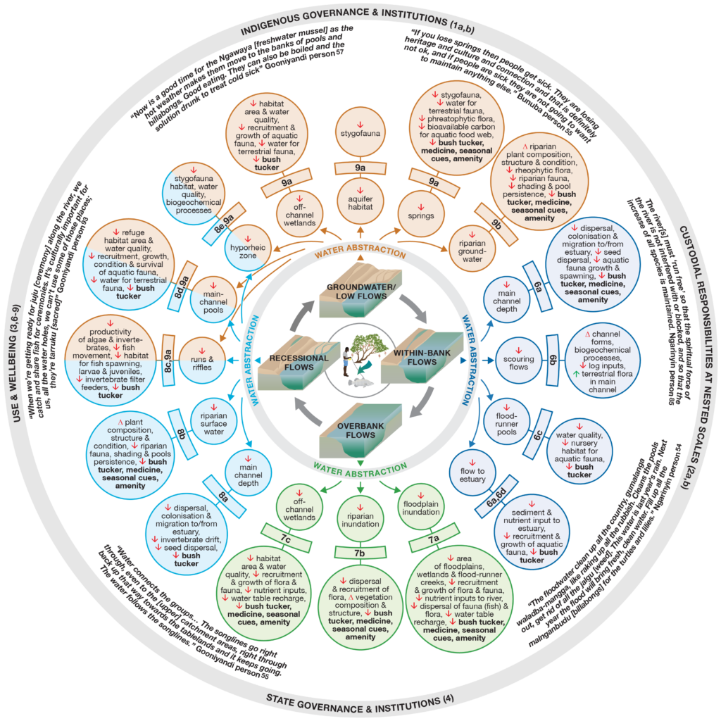
The initial hydro-socio-ecological conceptual model of the impacts of water abstraction in the Fitzroy River. The model is centred on four flow phases and the potential impacts of abstraction during each flow phase. Small inner circles describe impacts on hydrology and physical habitats, large outer circles describe impacts on habitat availability and quality, and water-dependent biota and ecological processes. Impacts of particular interest to Indigenous people are in bold type. The quotes illustrate Indigenous perspectives on hydro-socio-ecological relationships. The outer circle encompasses the key social factors and conditions that affect water allocation planning. Taken from Douglas et al. (2019). A pdf of the conceptual diagram is available by clicking here.

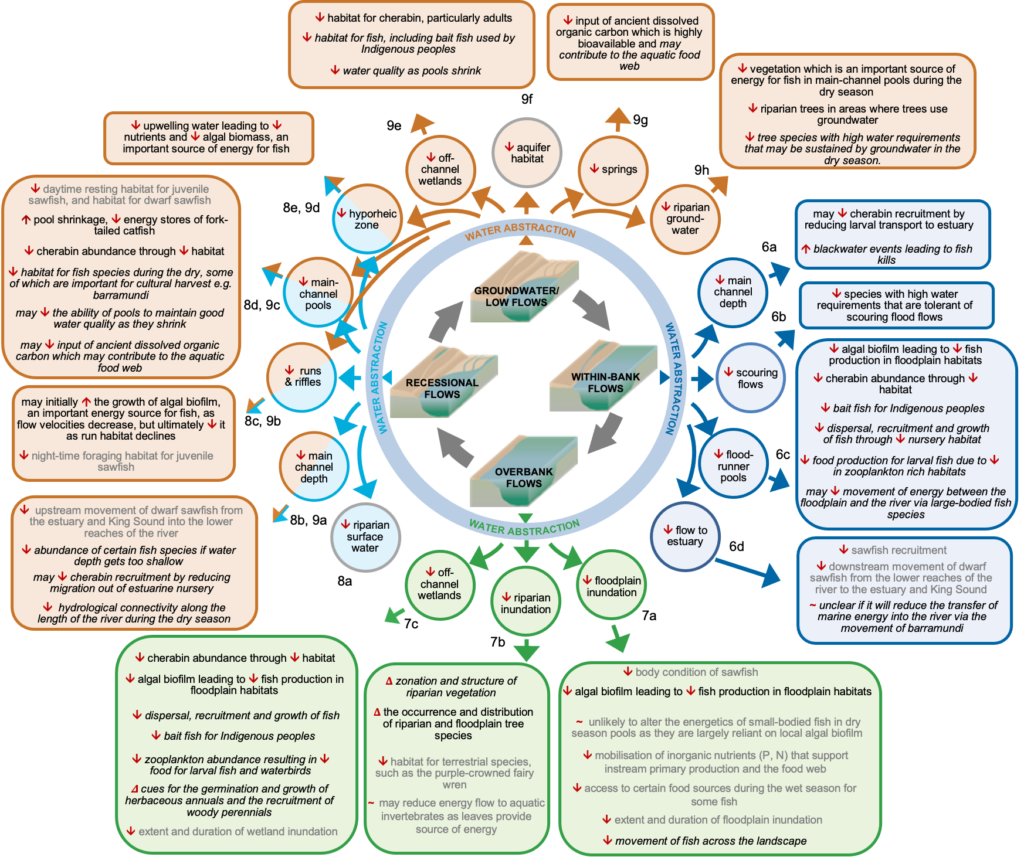
The revised conceptual model using only research undertaken in the Fitzroy River. Black text = evidence from this project, published; black text italicised = evidence from this project, unpublished. Grey text = evidence from other sources, published. The updated conceptual model can be found as a pdf here.

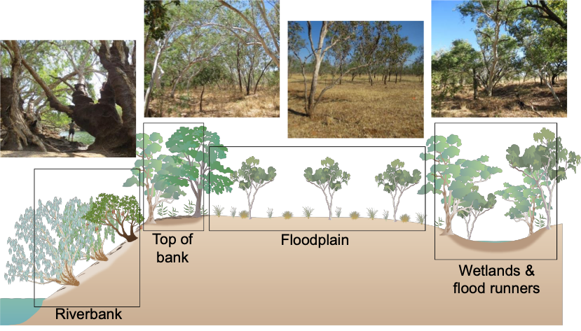
A representation of the zonation of riparian woody plants discussed in this factsheet, including photographs representative of each zone.
Want to know more about the Resilient Landscapes Hub's activities and our research into practical solutions to environmental problems? Stay informed about activities, research, publications, events and more through the Hub newsletter.
"*" indicates required fields