Jennifer Macdonald
Charles Darwin University-CSIRO
14 December 2021
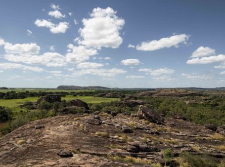
A First Nations-led project focusing on drone use guided by Traditional Owners in Kakadu National Park has developed protocols for responsible and ethical use of drones and other technologies on First Nations owned and managed land in Australia.
A researcher from Charles Darwin University (CDU), Dr Jennifer Macdonald, is the lead author of a newly published research paper on First Nations-led responsible innovation to guide drone use in monitoring the biocultural landscape in Kakadu.
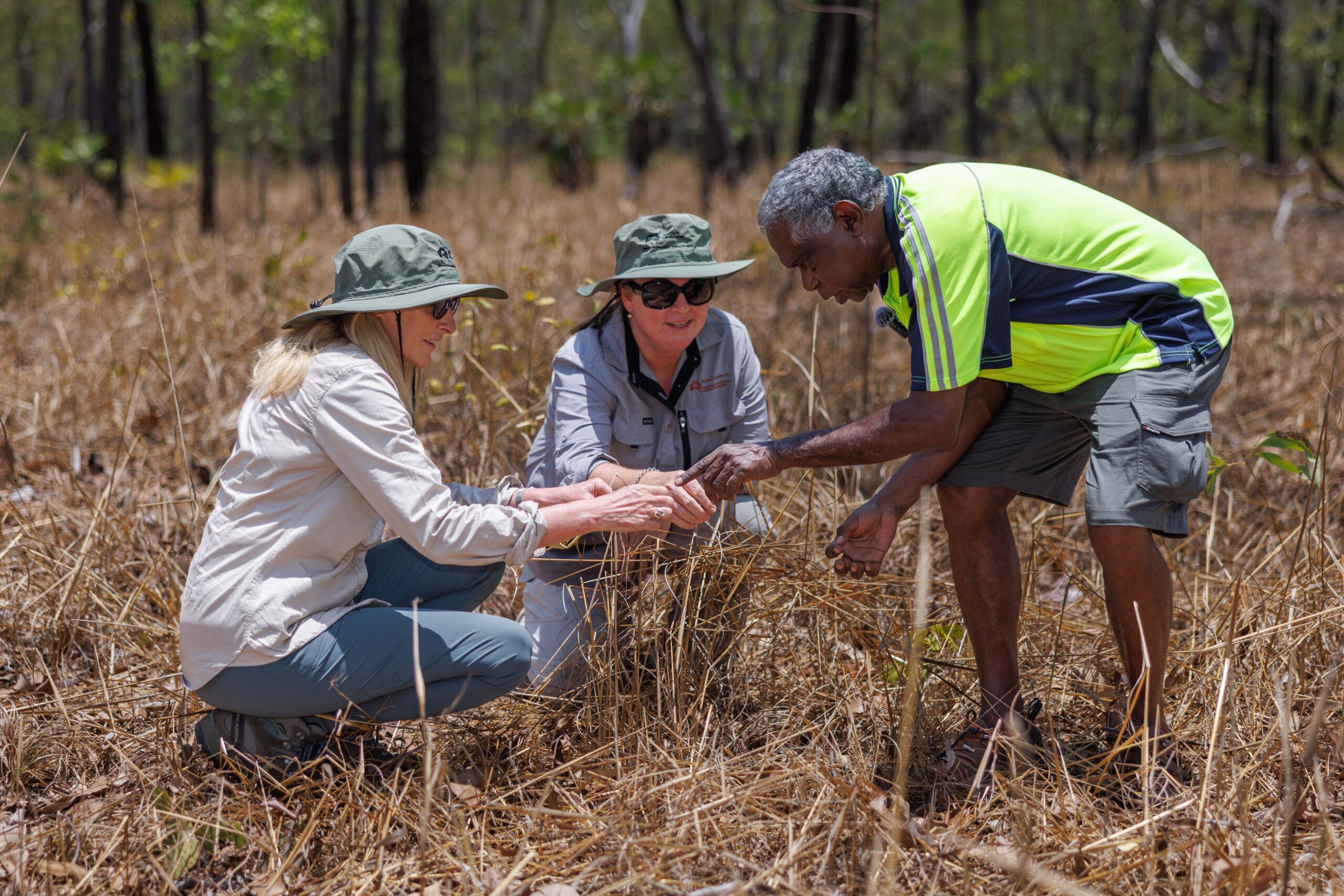
Bininj/Mungguy Traditional Owners and Rangers guided the choice of indicators and monitoring methods at each site. Photo Michael Douglas.
Through years of collaboration with Traditional Owners, First Nations ranger groups, researchers at CDU, CSIRO and the University of Western Australia, the team developed protocols through a National Environmental Science Program (NESP) Northern Australia Hub project for responsible and culturally appropriate use of technology on country.
The project is governed by an Indigenous Research Steering Committee and is focused on the development and trial application of Bininj and Mungguy healthy country indicators for monitoring in Kakadu.
The aim of this project is to enable First Nations rangers and Traditional Owners to use technology to monitor country before and after management interventions to improve the health of country. It is a collaborative research project that is empowering Traditional Owners to design and implement responsible technology use to monitor indicators of healthy country.
– Dr Jennifer Macdonald, CSIRO and Charles Darwin University
Some of the technologies currently used to monitor the health and biodiversity of First Nation lands include drones, motion sensor and video cameras.
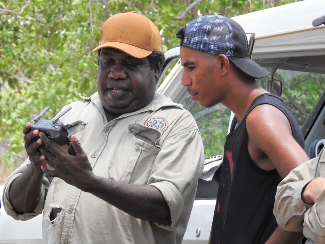
Drones offer exciting technical possibilities such as producing accurate wildlife and flora monitoring data and visualising hard-to-reach or inaccessible locations. But limited work has been done to make sure drones can be introduced responsibly.
Digital tools can enable people to make faster decisions about emerging and escalating threats to their country, and drones are widely used to understand what’s happening during management interventions. We need to think about how technology can help us care for country and manage issues such as weed invasion and fires. But we also need to be careful how we do that in a responsible and culturally respectful way. The question to think about is how could we design and use digital technologies from an ethical position that prioritises First Nation perspectives and knowledge practices?
– Dr Macdonald
One of the key approaches of the project is empowering First Nations people to lead the process and co-develop the guidelines.
We need to build trust and relationships and focus on benefitting Traditional Owners moving forward to the future.
– Dr Macdonald
You can find more information in a video about one of the Bininj/Mungguy case studies below or discover more on the project page or in the final report.
Charles Darwin University-CSIRO
Key Researcher
CSIRO
Hub Leader
The University of Western Australia
NAILSMA
Research Executive Committee and Western Node Leader
The University of Western Australia
Kakadu Indigenous Research Coordinator
Northern Land Council
Want to know more about the Resilient Landscapes Hub's activities and our research into practical solutions to environmental problems? Stay informed about activities, research, publications, events and more through the Hub newsletter.
"*" indicates required fields