Ben Stewart-Koster
Key Researcher
Griffith University
2 February 2022
Authors: Jane Thomas and Ben Stewart-Koster, Northern Australia Environmental Resources Hub, National Environmental Science Program
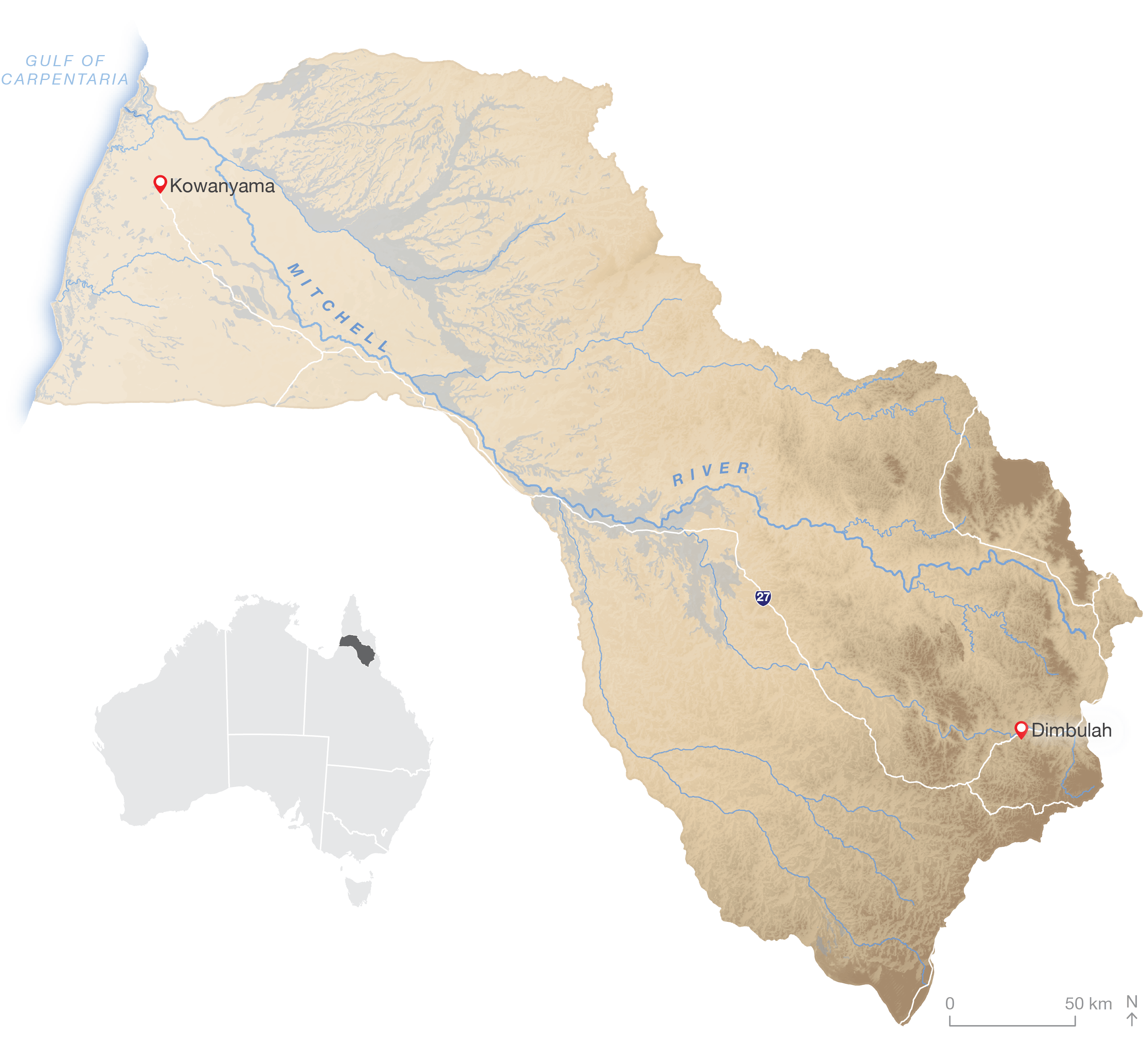
Wetlands Australia Sustaining the freshwater ecosystems and biodiversity of Queensland’s Mitchell River
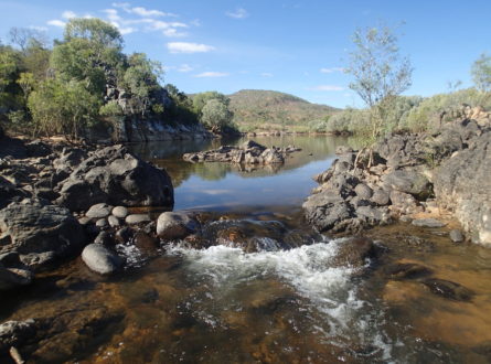
Queensland’s Mitchell River flows west from its headwaters in the rainforests of the Wet Tropics west to the Gulf of Carpentaria. New research has found just how important the Mitchell’s flows are to its freshwater habitats and biodiversity.
The waters of the Mitchell and its catchment support traditional uses by Indigenous Australians across 5 Nations, wetlands of national significance, threatened species, and commercial and recreational fisheries.
While the Mitchell is mostly free-flowing, the river has been identified as suitable for further water-resource development. A research project led by scientists from Griffith University investigated the importance of the Mitchell’s flows to floodplain inundation, aquatic food webs, fish movement and fisheries production.
The research found that the Mitchell River’s freshwater biodiversity – and the food and habitats that sustain it – depends on upstream flows and the connectivity they provide between the river and its floodplains.
Flows are important for all habitats in the Mitchell, including rivers, floodplain wetlands and coasts. They inundate floodplains, and the nutrients they deliver fuel the growth of aquatic plants and algae which supports the entire food web. Flows also connect highly productive floodplains and wetlands with their rivers. These hydrological connections contribute to increased growth rates and biomass of barramundi in the coastal fishery in the Gulf of Carpentaria. All species of fish move more easily when rivers and floodplains are connected by flows.
Given the importance of flows for the Mitchell’s freshwater biodiversity, these findings have direct relevance to environmental risk assessments for future water planning in the Mitchell catchment. Water-resource planning needs to consider the whole catchment, rather than regard each tributary as a separate ecological system.
While local rainfall is important, catchment flows from upstream are vital for inundation. Any reductions in wet-season flows from water-resource development are likely to impact floodplain inundation, particularly in years with limited cyclone activity in the Gulf of Carpentaria.
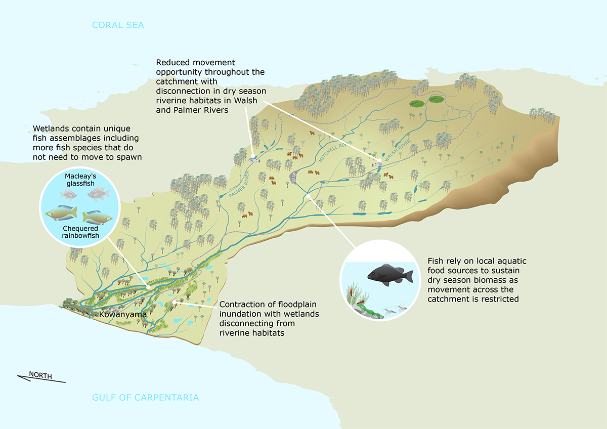
These findings have been summarised in 3 conceptual diagrams that depict the ecological processes in the dry season and wet season, and the predicted impacts of changes to the catchment.
Conceptual model of Mitchell River ecosystem function in the dry season. A pdf of this model is available here.
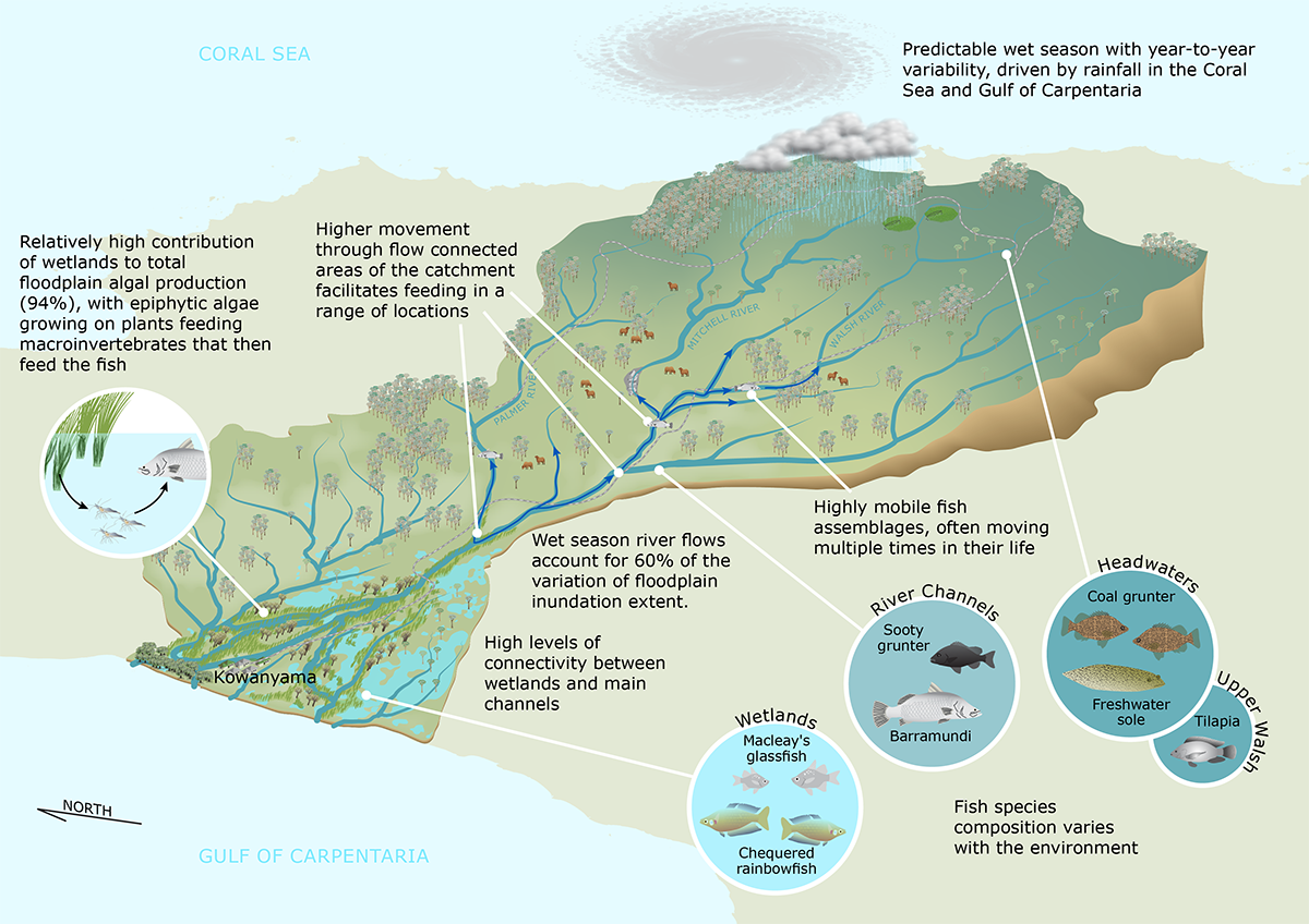
Conceptual model of Mitchell River ecosystem function in the wet season. A pdf of this conceptual model is available here.
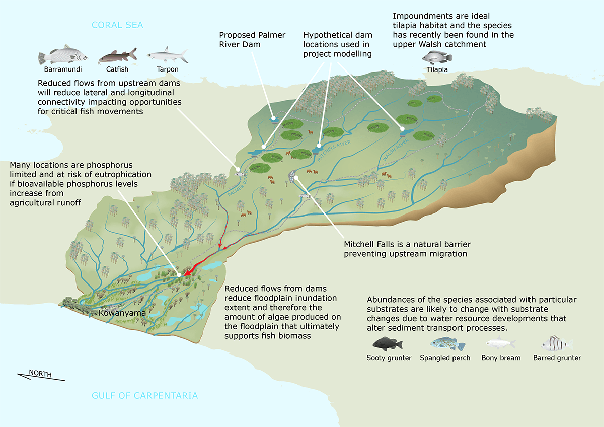
Conceptual diagram of possible threats from water-resource development to Mitchell River ecosystem function. A pdf of this conceptual model is available here.
This project was led by Dr Ben Stewart-Koster and Professor Stuart Bunn of Griffith University, supported through funding from the Australian Government’s National Environmental Science Program through its Northern Australia Environmental Resources Hub.
Key Researcher
Griffith University
Key Researcher
Griffith University
Griffith University
Project team member
Griffith University
Key Researcher
DESI (Queensland Government)
Griffith University
DAF (Queensland)
Charles Darwin University
Research Executive Committee and Eastern Node Leader
Griffith University
Want to know more about the Resilient Landscapes Hub's activities and our research into practical solutions to environmental problems? Stay informed about activities, research, publications, events and more through the Hub newsletter.
"*" indicates required fields