Vanessa Adams
Research Executive Committee and Southern Node Leader
University of Tasmania
12 April 2022
Much land-use planning occurs at relatively small scales because it is initiated by a development application. When someone wants to change the use of a parcel of land, a formal application is made for a permit. This small-scale land-use planning is limited to property boundaries and the local environment, making it difficult to consider broader implications and take advantage of change to achieve wider social and conservation goals. The kinds of local implications that are routinely considered are traffic, parking and impact on utilities such as water. A different planning instrument is needed to go beyond these limited considerations. This is where statutory regional land-use plans become important.
 |
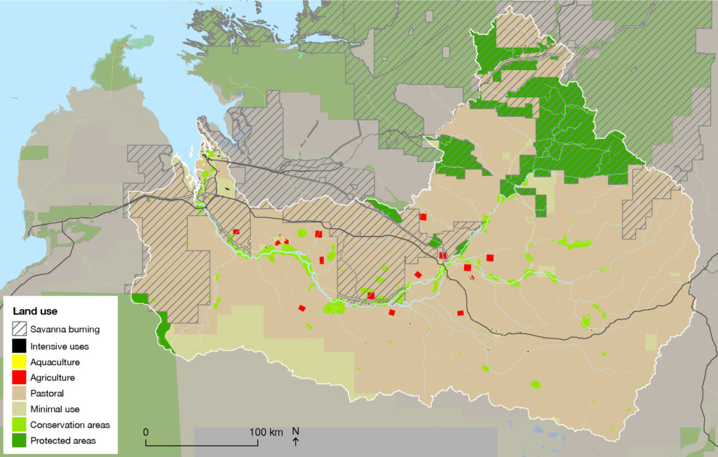 |
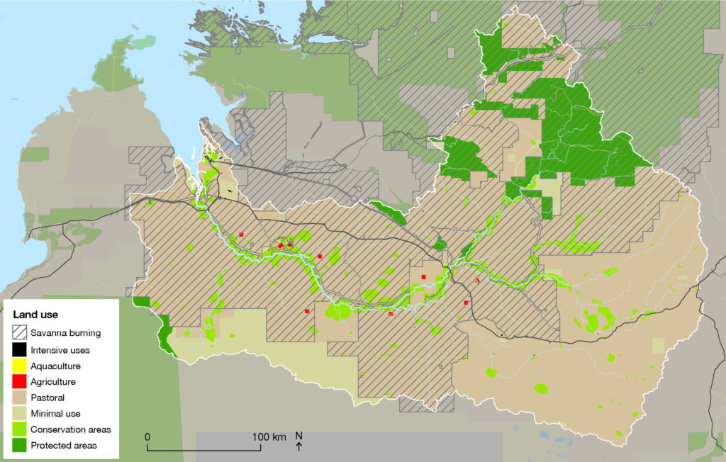
Scenario maps, such as these 2 possible future land-use maps from a NESP Northern Australia Hub project developed for the Fitzroy River catchment, are a potential outcome from regional land-use planning.
Land-use planning is a statute-based process that facilitates a discussion between stakeholders about future land use. Essentially, it is a set of rules about what can and cannot happen in areas of land and it is the conversation that occurs among the developer, decision-makers and other interested parties, including the public.
Regional plans are important to provide strategic direction for these local decisions. To be effective, these regional plans need to be statutory documents that are consistent with local planning schemes. Where there is conflict, the regional plan needs to take precedence. For example, Tasmania has 3 regional land-use strategies (1) under the Land Use Planning and Approvals Act 1993. These introduce urban growth boundaries and clarify long-term goals – such as housing density and overall objectives for the ways different areas contribute to the function of the region – for different zones. The planning schemes administered by local government need to respect these regional plans.
There is not much regional planning occurring in Australia outside of urban growth boundaries, some protections for agricultural land, formal nature reserves, and Regional Forest Agreements (2). Protections for agricultural land, such as the Priority Agricultural Land mapping in Western Australia and the non-spatially explicit State Policy on the Protection of Agricultural Land 2009 in Tasmania, are in place.
In additional to state tools, the other mechanism available for regional planning is under Part 10 of the Environment Protection and Biodiversity Conservation Act 1999 (EPBC Act). This allows for strategic environmental assessments (SEAs) that relate to an endorsed policy, plan or program. Despite this capacity under the EPBC Act for a suite of actions to get approval, there have only been 26 formal strategic assessments since it was introduced in the original EPBC Act and only 10 of those have been completed.
This tool was expected to be attractive to developers wanting a set of approvals. However, the length and complexity of the assessment process appears to have had the opposite effect and developers have tended to stick with an ad-hoc and just-in-time approach.
Completed SEAs have not been without challenges, as it can be difficult to achieve a balance between providing clear guidance about future land uses and being flexible enough to consider new information.
Plans that are little more than visionary documents tend to fail when development decisions are being made because local government decision-makers are unable to fall back on hard rules to support decisions.
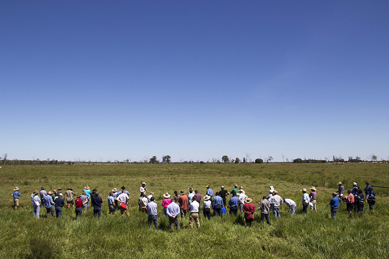
Regional planning can be used to bring together many stakeholders in a given region. Photo: Jaana Dielenberg.
Regional planning and strategic planning go hand in hand. Strategic decisions about future land use require a regional approach that responds to pressures such as traffic congestion, housing affordability, climate change and declining biodiversity. Thinking about the desired future state of a large area means that water catchments, bushland connectivity and the amount of vegetated land (3) can be considered at a meaningful scale and guide decisions at a local level.
The Samuel’s 2020 review (4) of the the EPBC Act highlighted the importance of regional planning in addressing some of the Act’s failings. The introduction of ‘hard lines’ and ‘no-go zones’ as part of a spatially explicit and well-considered regional plan could introduce habitat protections that are currently very difficult to achieve. Effective regional planning needs to be clear early about hard protections for natural values.
One of the lessons of regional planning is that an adaptive approach is needed. Regional planning is a complex task involving many stakeholders, some of whom are likely to be in direct conflict in terms of values and vision. Regional recovery planning that covers multiple natural values (particularly threatened species), sustainable development and staged developments are all important for identifying successes and failures and adapting accordingly.
A regional plan that can guide sustainable development decisions has:
These summaries are works in progress and you can contact Dr Vanessa Adams if you have constructive feedback on these summaries.
Want to know more about the Resilient Landscapes Hub's activities and our research into practical solutions to environmental problems? Stay informed about activities, research, publications, events and more through the Hub newsletter.
"*" indicates required fields