Helen Murphy
CSIRO
Littoral rainforest occurs at the interface between terrestrial and marine systems, protecting communities and infrastructure from erosion, and providing many ecosystem services such as mitigating flooding and providing specialised habitat for species such as cassowaries.
Because of its coastal location and fragmentation, littoral rainforest is vulnerable to interacting effects of extreme storm events, sea-level rise and changing land-use.
It is listed as Critically Endangered under the Environment Protection and Biodiversity Conservation Act 1999. The EPBC Act listing advice describes the broad characteristics of the community, however fine-scale mapping and an assessment of key threats was required by a number of research users in order to determine its exact location and extent, to assess climate change impacts, and to prioritise areas for management.
This project addressed an Australian Government priority research area and the work has been used directly by the Department of Environment and Energy to inform the draft Recovery Plan for ‘Littoral rainforest and costal vine thickets of eastern Australia’.
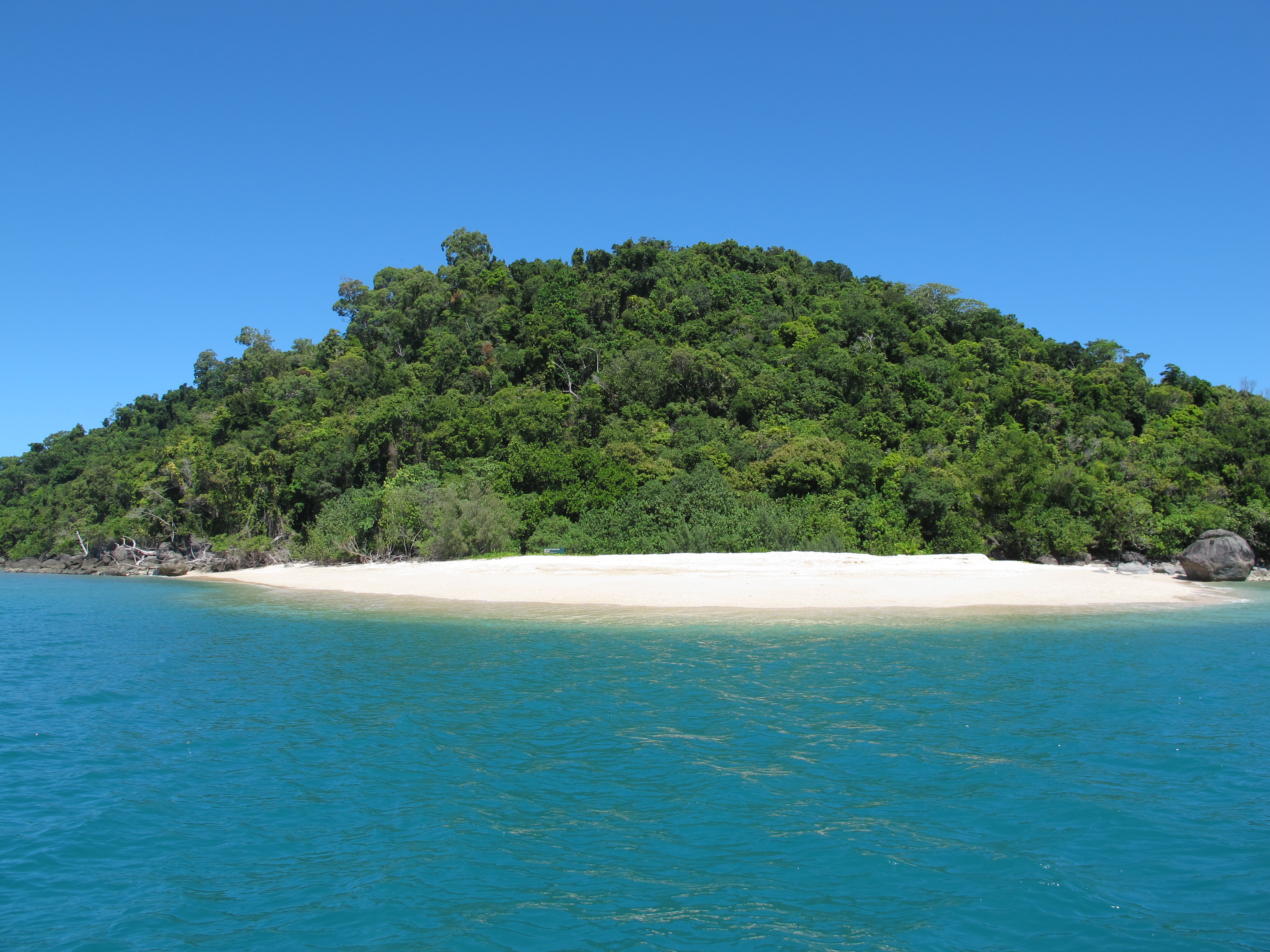
Example of critically endangered littoral rainforest. Photo by Andrew Ford.
The research has provided the Department of Environment and Energy, the Queensland Parks and Wildlife Service, the FNQ Regional Organisations of Councils and Local Councils with fine-scale mapping layers and an agreed method and template method to map littoral rainforest occurrence in the field, as well as a good understanding of the potential spatial impacts of storm surge, sea-level rise and coastal flooding on the forest. This is assisting them to improve policy, planning and management for the forest as well as to evaluate the potential impacts of proposed developments and climate change.
For example, the project team worked with Cairns Regional Council to help identify littoral rainforest patches in intensively developed beach suburbs where coastal vegetation is often subject to many varied pressures. The Council is now equipped to make their own assessment of patches which are mapped as ‘potential’ littoral rainforest so they can be managed appropriately to retain the values that littoral rainforest provides, and in accordance with the EPBC Act.
Researchers are working with Queensland Herbarium staff to update regional ecosystem mapping, and specifically to annotate regional ecosystem descriptions to note if littoral rainforest is present or potentially present in an area. Regional ecosystem information and maps are essential tools for business, governments, landholders and organisations to plan and manage developments, the natural environment, vegetation restoration and carbon farming. The information is also used for the Vegetation Management Act, Environmental Protection Act, the Environment Protection and Biodiversity Conservation Act and to determine the regional ecosystem status.
It’s now easier for Queensland National Parks staff to understand what forest types they have on their land throughout the Wet Tropics, their resilience to future storm surge and sea-level rise, and how to better manage them. In another example, the project team, with the assistance of Queensland Marine Parks staff, assessed several Great Barrier Reef island National Parks for the presence of littoral rainforest where there is currently no regional ecosystem mapping. These assessments provided Parks staff with new knowledge about the distribution of this endangered ecological community on their estate.
The research has been used to inform a National Climate Change Adaptation Research Facility NCCARF CoastAdapt case study, and Terrain NRM and the Wet Tropics Management Authority have expressed interest in using the work.
The methodology for mapping littoral rainforest produced by the project could be applied throughout Queensland to provide greater clarity about the location of this critically endangered ecological community and enable improved management.
Research outputs
Attributions