Keywords: riparian, riverbank, vegetation, Ranger Uranium Mine, ERA, RUM, Kakadu National Park, KNP, Kakadu, uranium, magnesium sulfate, salty plumes, salt plumes, flood plumes, flooding, floodplain, Magela Creek, trees, plants, flora, damage, groundwater, groundwater uptake, closure criteria, minesite rehabilitation, mine site rehabilitation, healthy creeks, ecosystem services, ecosystem benefits, river health, bank stabilisation, dry season water needs
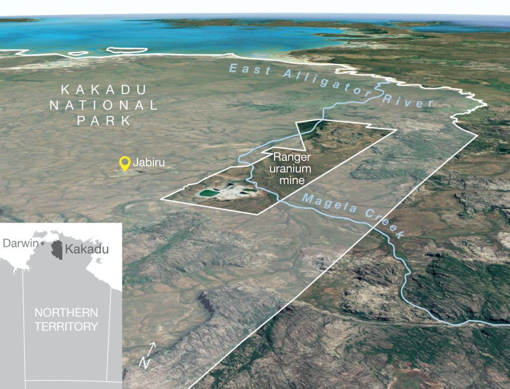
Ranger uranium mine is surrounded by Kakadu National Park. The mine has ceased operations and rehabilitation works are due to be completed by 2026. Spring-fed monsoon vine forests and riparian (riverbank) vegetation depend on soil and groundwater and provide essential habitat for the highly diverse aquatic ecosystems of the freshwater Magela Creek, which flows through the mine lease. Contamination of shallow groundwater with mine wastewater after rehabilitation of the site could have significant impact on this riparian vegetation and stream health.
This study has improved the knowledge of how common woody riparian plants use and depend on groundwater, which will help predict impacts from contaminants and inform mine closure and monitoring.
The project:

Location of Ranger uranium mine adjacent to Kakadu National Park.
The Northern Australia Environmental Resources Hub addressed key research questions to come up with practical, on-ground solutions to some of the north’s most complex environmental challenges. A transdisciplinary research approach has been at the heart of the hub. Integrating key research users – policy-makers and land managers including Traditional Owners and ranger groups – into the co-design of research projects has led to rapid uptake of research outcomes into land management practices and decision-making. The hub has produced this wrap-up video outlining these impacts from the perspectives of research users.
This project was led by Professor Lindsay Hutley from Charles Darwin University (CDU). Professor Hutley was assisted by researchers from CDU, The University of Western Australia and the Supervising Scientist Branch of the Department of Agriculture, Water and the Environment.
This project was completed in September 2021.
Contact
Lindsay Hutley, Charles Darwin University