Vanessa Adams
Research Executive Committee and Southern Node Leader
University of Tasmania
Project start date: 01/07/2022
Project end date: 31/03/2023
NESP funding: $139,984 (GST-exclusive)
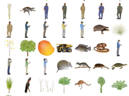
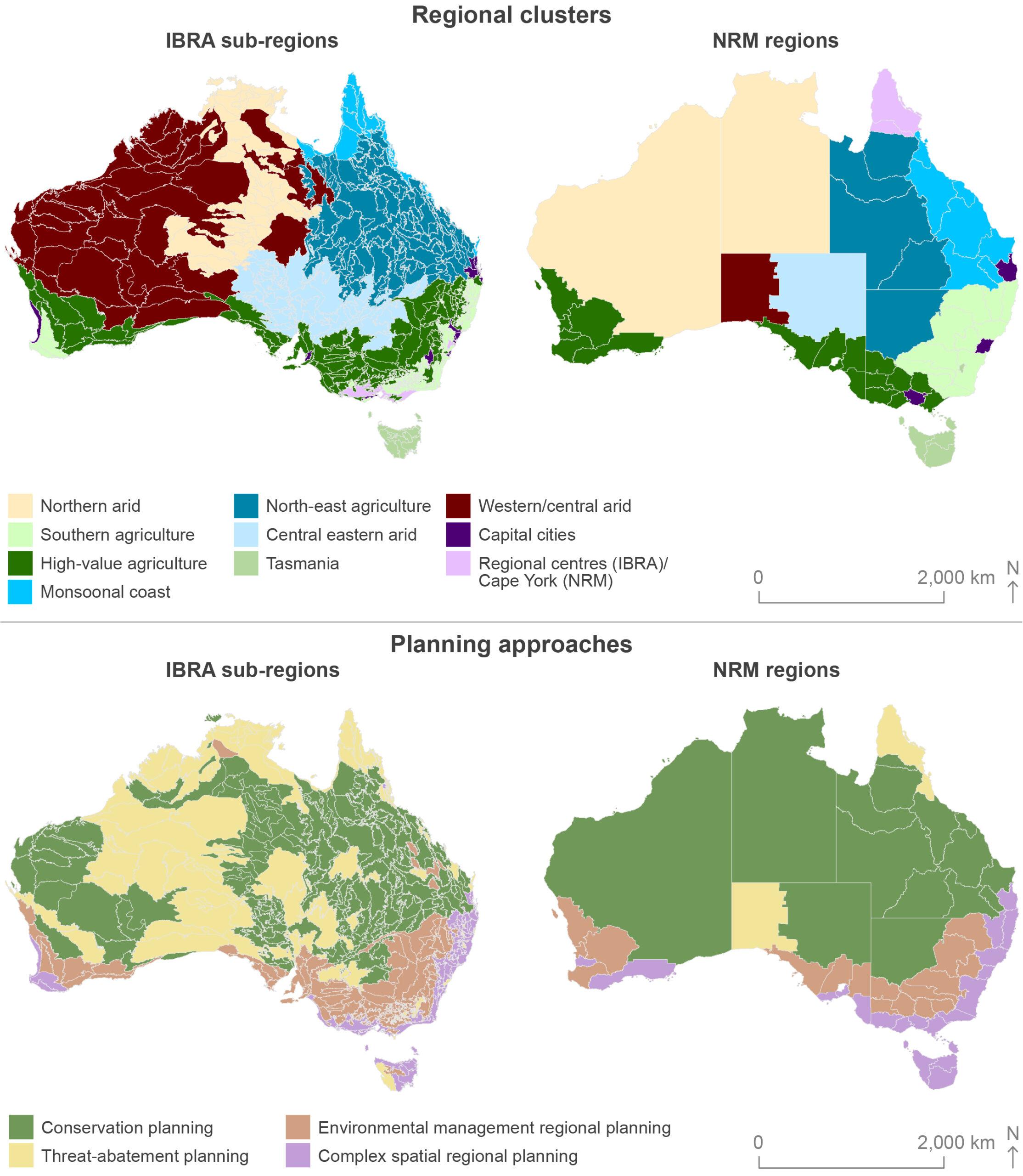
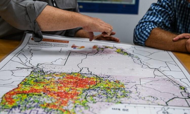
Hub researchers have created integrated datasets which demonstrate social and ecological similarities between the regions analysed. These datasets were then visualised as a series of simple-to-use maps showing regions that share similar characteristics and are therefore likely to support similar conservation and land-management interventions. The maps are presented alongside tables which describe core social, ecological and interactive variables for different regions.
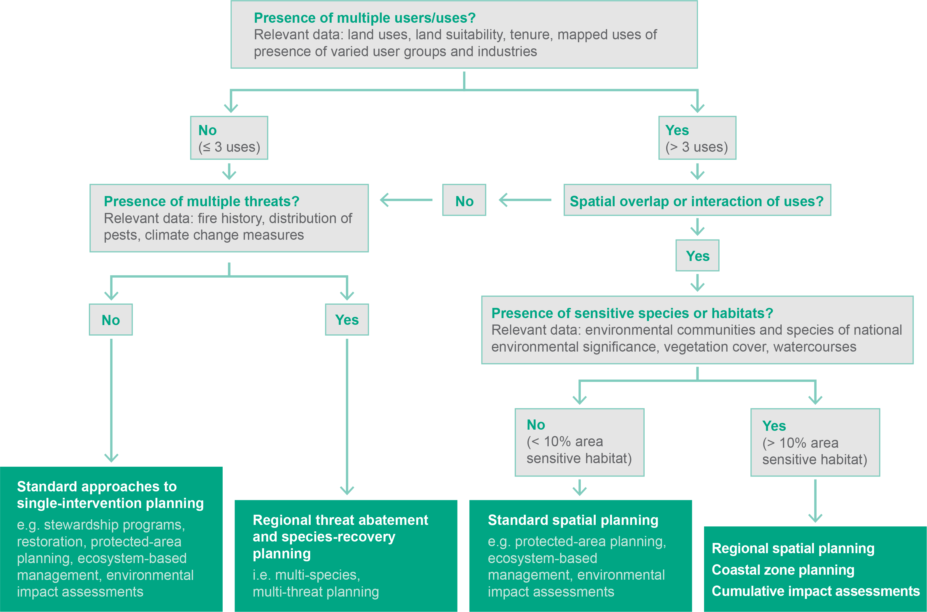
The report also includes a decision-making tree to assist land managers in determining best-practice conservation actions. These outcomes will help to support biodiversity and ecosystems across Australia and increase the potential impact of conservation and land-management research.
Read more in the final report.
Scientific Paper
December 2024 | Open Access
How integration of socio-ecological data can shape regional environmental management decisions: an example from Australia
Larson, S., Stoeckl, N., Jia, J., & Adams, V. M. (2024). How integration of socio-ecological data can shape regional environmental management decisions: an example from Australia. Australasian Journal of Environmental Management, 1–18. https://doi.org/10.1080/14486563.2024.2433995
Report
November 2024
Resilient Landscapes Hub 2023 Annual Progress Report
Scientific Paper
November 2024 | Open Access
Integrated social-ecological data for regional natural resource management
Adams, V. M., Allen, S., Steel, R., Stoeckl, N., & Larson, S. (2024). Integrated social-ecological data for regional natural resource management. Data in Brief, 52, 109806. https://doi.org/10.1016/j.dib.2023.109806
Report
October 2023
Supporting knowledge sharing, natural resource management and regional planning: identifying similar regions through integrated data analysis (final report)
Stoeckl N, Adams VM, Larson S, Allen S, Jia J, Boothroyd A and Steel R (2023) Supporting knowledge sharing, natural resource management and regional planning: identifying similar regions through integrated data analysis, report to the Resilient Landscapes Hub of the Australian Government’s National Environmental Science Program. University of Tasmania, Hobart.
Report
June 2023
Resilient Landscapes Hub 2022 Annual Progress Report
Other
July 2022
Resilient Landscapes Hub 2021 Annual Progress Report
Project leader
The project was led by Associate Professor Vanessa Adams from the University of Tasmania. This project contributed to 3 cross-cutting initiatives:
Contact
For further information, contact vm.adams@utas.edu.au or nesplandscapes@uwa.edu.au.
Research users
People
Research Executive Committee and Southern Node Leader
University of Tasmania
Key researcher
University of Tasmania
Research Executive Committee and Eastern Node Leader
Griffith University
Research Executive Committee and Northern Node Leader
James Cook University