Lindsay Hutley
Key Researcher
Charles Darwin University
Keywords: riparian, riverbank, vegetation, Ranger Uranium Mine, ERA, RUM, Kakadu National Park, KNP, Kakadu, uranium, magnesium sulfate, salty plumes, salt plumes, flood plumes, flooding, floodplain, Magela Creek, trees, plants, flora, damage, groundwater, groundwater uptake, closure criteria, minesite rehabilitation, mine site rehabilitation, healthy creeks, ecosystem services, ecosystem benefits, river health, bank stabilisation, dry season water needs
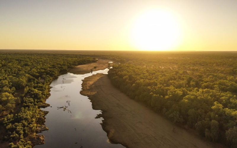
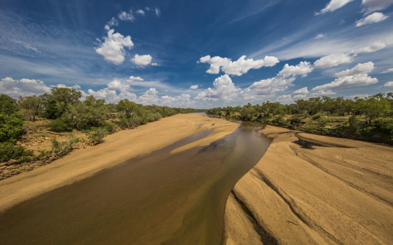
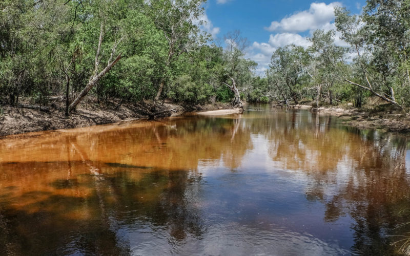
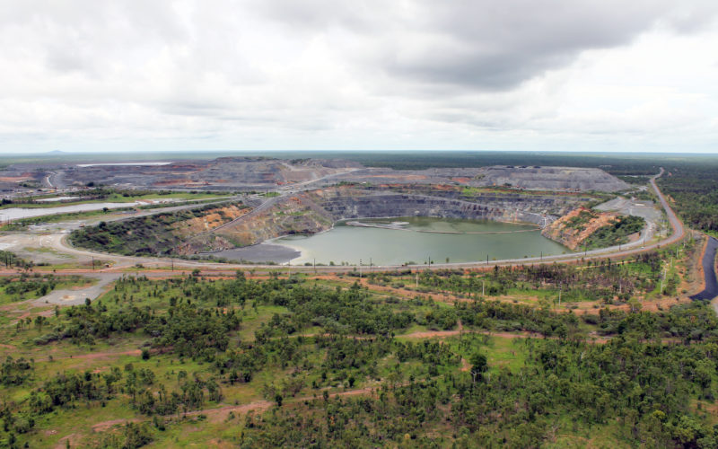
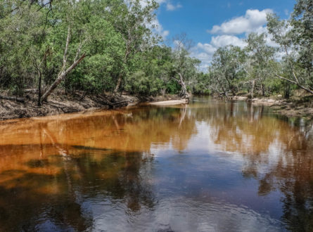
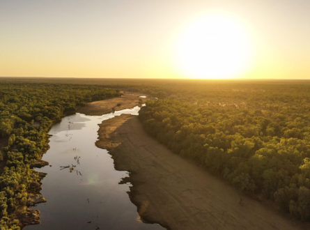
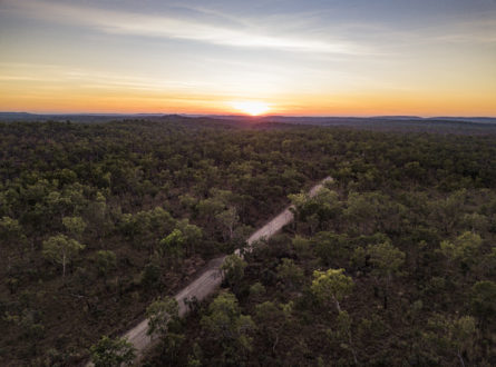
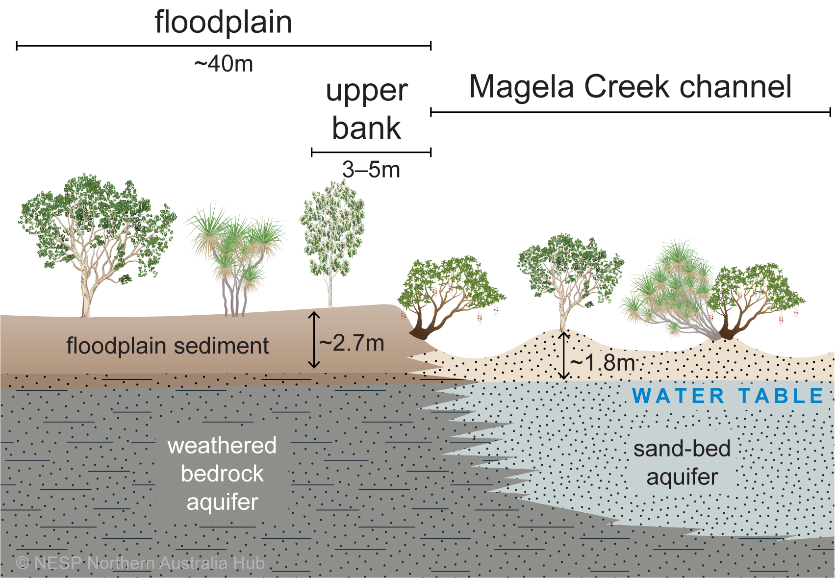
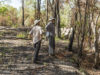
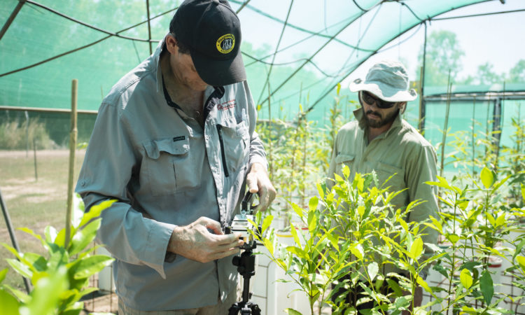
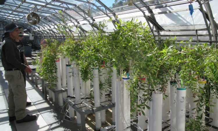
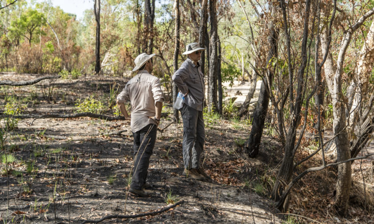
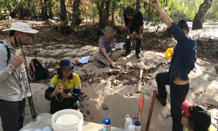
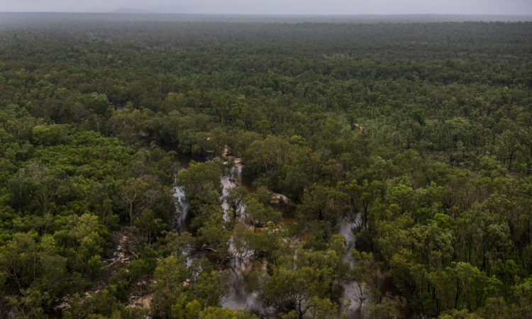
Ranger uranium mine is surrounded by Kakadu National Park. The mine has ceased operations and rehabilitation works are due to be completed by 2026. Spring-fed monsoon vine forests and riparian (riverbank) vegetation depend on soil and groundwater and provide essential habitat for the highly diverse aquatic ecosystems of the freshwater Magela Creek, which flows through the mine lease. Contamination of shallow groundwater with mine wastewater after rehabilitation of the site could have significant impact on this riparian vegetation and stream health.
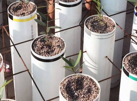
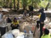
This study has improved the knowledge of how common woody riparian plants use and depend on groundwater, which will help predict impacts from contaminants and inform mine closure and monitoring.
The project:
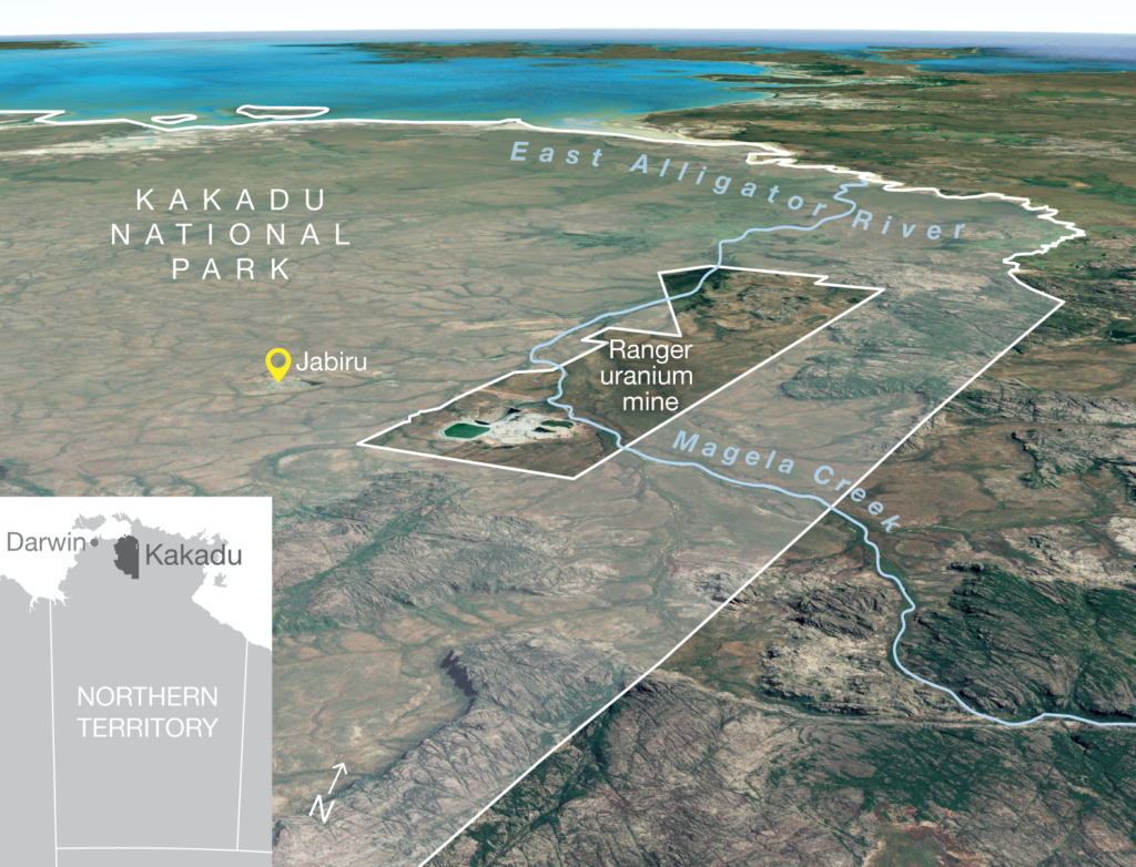
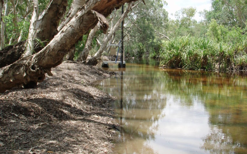
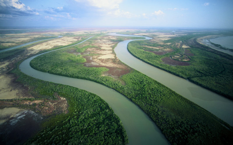
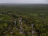
Location of Ranger uranium mine adjacent to Kakadu National Park.
Report
July 2022
Northern Hub Final Report 2021
Northern Australia Environmental Resources Hub. 2021. Northern Australia Environmental Resources Hub Final Report. Charles Darwin University, Darwin.
Scientific Paper
November 2021
Deuterium depletion in xylem water and soil isotopic effects complicate the assessment of riparian tree water sources in the seasonal tropics (scientific paper)
Duvert, C, Canham, CA, Barbeta, A, et al. Deuterium depletion in xylem water and soil isotopic effects complicate the assessment of riparian tree water sources in the seasonal tropics. Ecohydrology. 2021;. Accepted Author Manuscript. e2383 https://doi.org/10.1002/eco.2383
Report
October 2021
Ecohydrology and sensitivity of riparian flora, Magela Creek, Ranger uranium mine (final report)
Hutley LB, Duvert C, Setterfield SA, Bourke A, Canham CA, Freestone FL, Cavalieri OO, Alvarez-Cortez D and Brand M (2021) Ecohydrology and sensitivity of riparian flora, Magela Creek, Ranger uranium mine. Charles Darwin University, Darwin.
Video
August 2021
NESP Northern Hub wrap-up video
Impact Storie
May 2021
Engagement is a two-way street: Creating symbols for science communication (impact story 2020)
Other
March 2021
More Than Words (CSIRO Double Helix article Jan 2021)
Impact Storie
October 2020
Filling knowledge gaps for the rehabilitation of Ranger uranium mine (impact story 2019)
Info Sheet
May 2020
Tree water use and sensitivity to contaminated mine water (project update April 2020)
Scientific Paper
February 2020 | Open Access
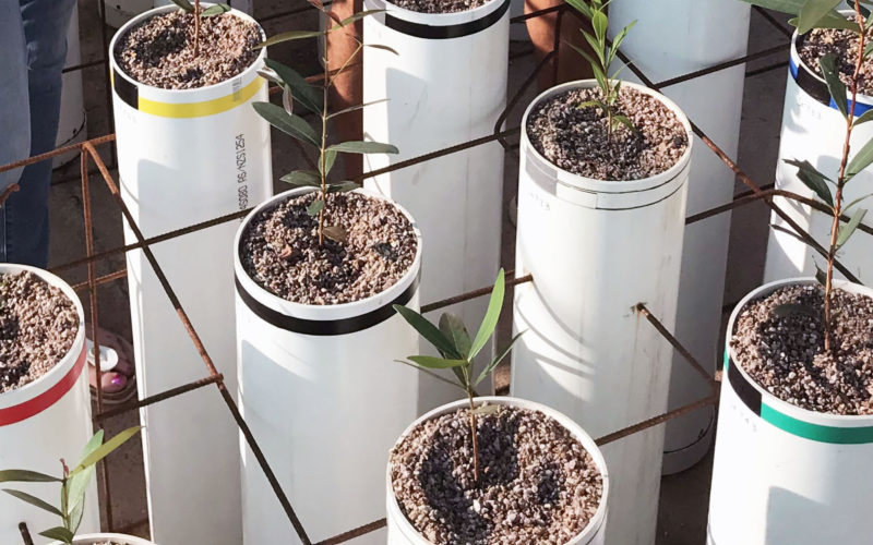
Effect of elevated magnesium sulfate on two riparian tree species potentially impacted by mine site contamination (scientific paper)
Canham, C.A., Cavalieri, O.Y., Setterfield, S.A. et al. Effect of elevated magnesium sulfate on two riparian tree species potentially impacted by mine site contamination. Sci Rep 10, 2880 (2020). https://doi.org/10.1038/s41598-020-59390-9
Scientific Paper
February 2020
Effect of elevated magnesium sulfate on two riparian tree species potentially impacted by mine site contamination (scientific paper dataset)
Canham, C. (Creator), Cavalieri, O. Y. (Creator), Setterfield, S. (Creator), Freestone, F. (Creator) & Hutley, L. B. (Creator). (19 Feb 2020). Effect of elevated magnesium sulfate on two riparian tree species potentially impacted by mine site contamination. The University of Western Australia. https://doi.org/10.26182/5e61d3ad6a460
Info Sheet
July 2018
Tree water use and sensitivity to contaminated mine water (start-up factsheet)
Other
May 2017
Top End research overview (brochure Jun 2018)
This project was led by Professor Lindsay Hutley from Charles Darwin University (CDU). Professor Hutley was assisted by researchers from CDU, The University of Western Australia and the Supervising Scientist Branch of the Department of Agriculture, Water and the Environment.
This project was completed in September 2021.
Contact
Lindsay Hutley, Charles Darwin University
![]()
![]()
![]()
Key Researcher
Charles Darwin University
Charles Darwin University
Research Executive Committee and Western Node Leader
The University of Western Australia
Project team member
The University of Western Australia
Project team member
The University of Western Australia